Dies ist der gesamte Blog der Reise-Abschnitte unserer Kanada-Reise durch Britisch Columbia und die Northwest Territories bis Yellowknife im Sommer.
Er enthält die Reise von den Rocky Mountains durch Vancouver, Vancouver Island, die Inside Passage, den Nordwesten von British Columbia und den Südwesten der Northwest Territories von Ende Juli bis Mitte August (auf 2 langen Seiten):
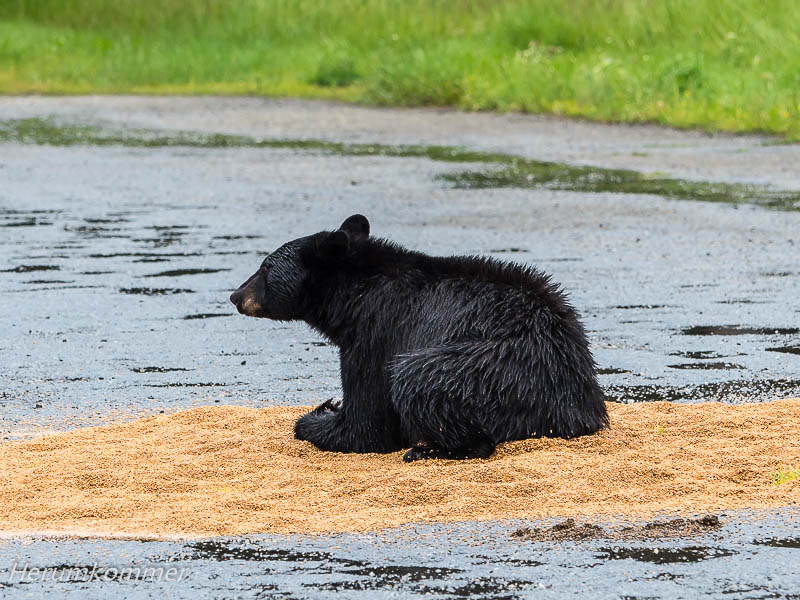
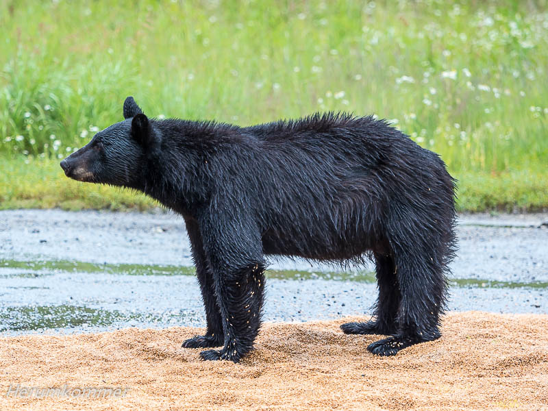
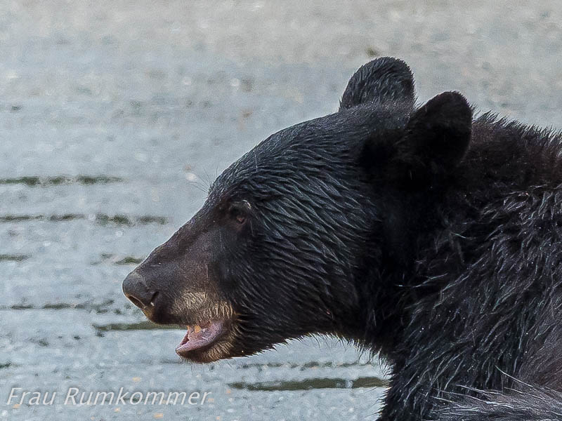
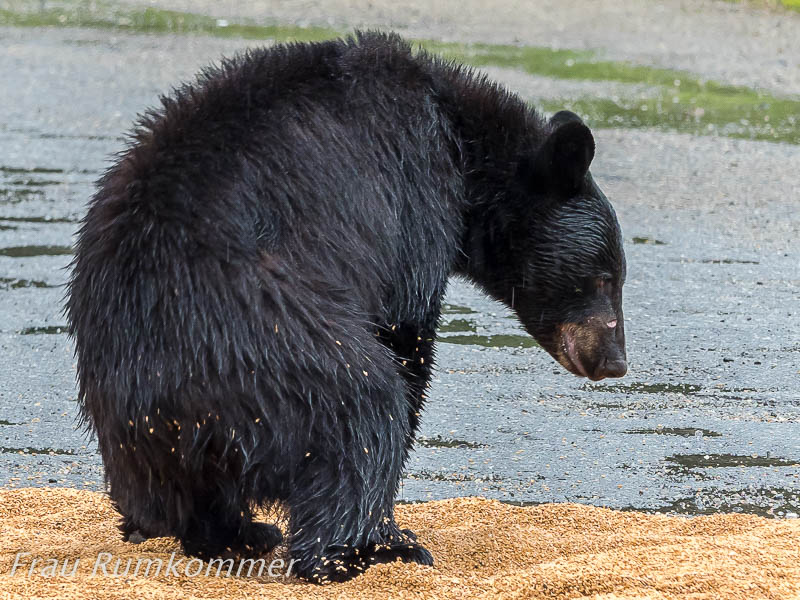
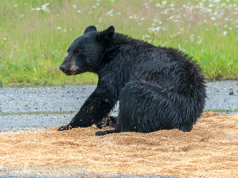
This is the entire blog of the travel sections of our Canada trip through British Columbia and the Northwest Territories to Yellowknife in the summer. Auf der Weiterfahrt von Jasper in Richtung Vancouver beginnt es zu regnen. Auf dem Southern Yellowhead Highway südlich von Valemount fahren wir an einem großen, leeren LKW-Parkplatz vorbei. Leer? Da ist doch ein Bär! Zurück, das müssen wir sehen. Auf dem Platz sind zwei ca. fünf Meter große Flächen verschütteter Getreidekörner. In einer davon hat ein Schwarzbär sein Fressen gefunden. Er sitzt, liegt, steht in den Cerealien und frist davon so viel er kann. Hin und wieder blickt er in die Runde, denn außer uns stehen dort inzwischen noch zwei Fahrzeuge mit Menschen, die diese herrliche Szene fotografieren. Als ein weiteres Fahrzeug kommt und zu nah heran fährt, macht sich der Bär davon, in den nahen Wald.
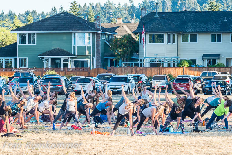
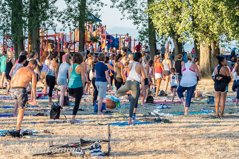
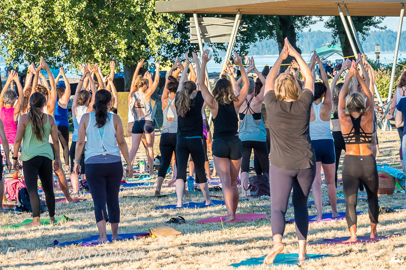
Found meal On the way from Jasper towards Vancouver it starts to rain. On the Southern Yellowhead Highway south of Valemount we drive past a large, empty truck parking lot. Empty? There is a bear! Back, we have to see that. On the square are two approximately five meters large areas of spilled cereal grains. In one of them, a black bear has found his food. He sits, lies, stands in the cereals and eats as much of it as he can. Every now and then he looks around, because besides us meanwhile there are two vehicles with people photographing this beautiful scene. When another vehicle arrives and drives too close, the bear makes off in the nearby forest. Es ist Sonntag, als wir uns Vancouver nähern, und so geraten wir von einem Verkehrsstau in den nächsten. Aber wir haben ja keinen Termin, also arbeiten wir uns geduldig durch bis nach Tsawwassen auf der südwestlichen Halbinsel der Stadt. Auf der Suche nach einem Übernachtungsplatz entdecken wir dort am Strand eine Art Massen-Yoga.
To Vancouver Island It’s Sunday as we approach Vancouver, so we get stuck in traffic jams. But we have no appointment, so we work patiently through to Tsawwassen on the southwestern peninsula of the city. In search of a place for the night, we discover a kind of mass yoga on the beach there.
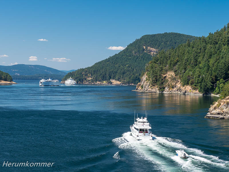
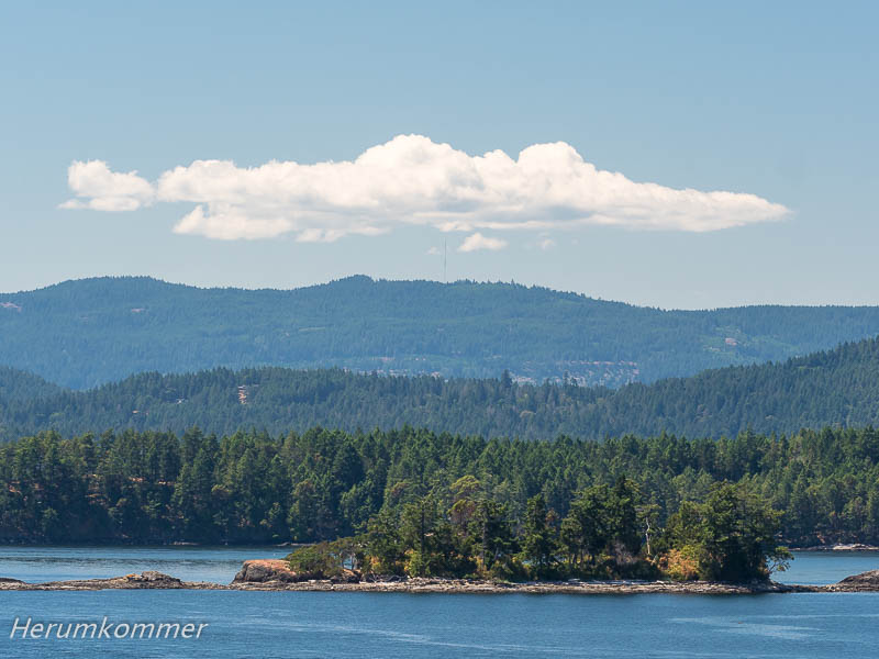
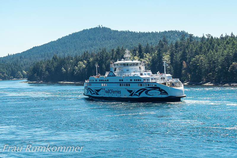
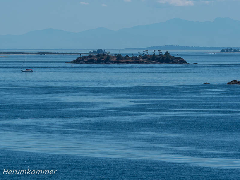
Von einer künstlichen Halbinsel, unmittelbar an der US-Grenze, fährt eine Fähre nach Vancouver Island. Zunächst geht es ein kurzes Stück durch US-Gewässer, dann durch den Gulf Islands National Park. Hier herrscht reger Schiffsverkehr zwischen den Inseln. Zielhafen ist Swartz Bay bei Sidney, nördlich von Victoria.
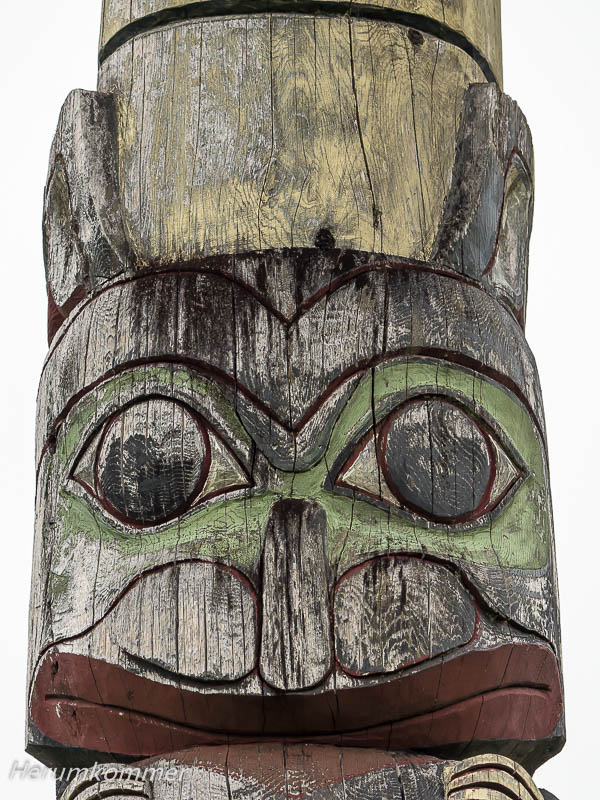
From an artificial peninsula, just off the US border, a ferry goes to Vancouver Island. First, it’s a short stretch through US waters, then through the Gulf Islands National Park. Here there is a lot of traffic between the islands. The destination port is Swartz Bay near Sidney, north of Victoria. In Brentwood Bay, bei Sidney auf Vancouver Island, kommen wir in ein Gebiet von First Nations. Hier haben sie das moderne Gesundheitszentrum ‚Tsartlip Health Station‘ eingerichtet, das mit beeindruckenden Totems dekoriert ist.
At Brentwood Bay, near Sidney on Vancouver Island, we enter a territory of First Nations. Here they have set up the modern ‚Tsartlip Health Station‘, which is decorated with impressive totems. Sidney, auf der Saanich-Halbinsel nördlich von Victoria, ist eine hübsche kleine Stadt. Die zentrale Einkaufsstraße mit einigen ungewöhnlichen Geschäften und der Beacon Park am Meer sind als ‚Sculpture Walk‘ deklariert. Diverse Künstler haben nicht nur Skulpturen sondern auch Wandbilder und aufwändige Gemälde an profanen Einrichtungen, wie z.B. Trafostationen, geschaffen.
Sidney, on the Saanich Peninsula north of Victoria, is a pretty little town. The central shopping street with some unusual shops and the Beacon Park by the sea are declared as ‚Sculpture Walk‘. Various artists have created not only sculptures but also murals and elaborate paintings on profane equipment, such as Transformer stations. Wir fahren von Sidney kommend auf der Küstenstraße nordöstlich und östlich von Victoria. Sie gilt als landschaftlich schöner ‚Scenic Drive‘. Aber über eine längere Strecke sehen wir weder Küste noch das Meer und sind schon enttäuscht. Doch in Oak Bay geht, wie durch ein Fenster, der Blick auf eine Marina. Aber was ist das? Da steht ein Klavier auf der Wiese. Und jemand spielt darauf! Der Bezirk Oak Bay hat mit Unterstützung von Sponsoren mehrere Klaviere beschafft, von verschiedenen Künstlern bemalen lassen und an markanten Stellen am Meer aufgestellt. Eine leicht abnehmbare Schutzhülle hält Niederschläge ab.
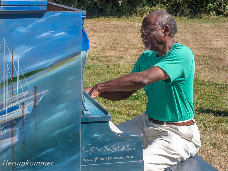
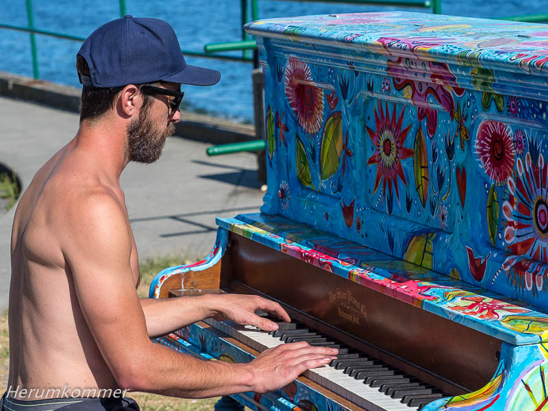
Romanticism in Oak Bay We drive from Sidney on the coastal road northeast and east of Victoria. It is considered a ‘scenic drive’. But over a longer distance we see neither coast nor the sea and are already disappointed. But at Oak Bay, as if through a window, there is a view of a marina. But what is that? There is a piano in the meadow. And someone plays on it! The District of Oak Bay, with the support of sponsors, has procured several pianos, painted by various artists, and placed in prominent locations by the sea. An easily removable protective cover keeps rain out.
Der Pianist ist Carl Ivey, Doktor der Medizin, pensionierter Kinderarzt und US-Bürger, der sich freut, dass er in Kanada leben kann (und mit Victoria er hat sich eine besonders attraktive Gegend ausgesucht). Er ist hoch erfreut, dass wir angehalten haben und seinem Spiel lauschen. Da wir aus Hamburg kommen, spielt er für uns ein Stück des Hamburger Komponisten Brahms.
The pianist is Carl Ivey, MD, retired pediatrician and US citizen, who is pleased to be able to live in Canada (and with Victoria he has chosen a particularly attractive area). He is delighted that we stopped and listen to his play. Since we are from Hamburg, he plays a piece by the Hamburg composer Brahms for us. Nach dieser wunderbaren Begegnung setzen wir unsere Fahrt fort. Ein paar Kilometer weiter entdecken wir noch ein farbenfrohes Piano am Meer. Während wir es noch fotografieren, kommt ein junger Mann auf dem Fahrrad, stellt es ab und beginnt zu spielen. Kyle Argue tritt gelegentlich in Bands auf, und wie Carl spielt er virtuos.
After this wonderful encounter, we continue our journey. A few kilometers further we discover another colorful piano by the sea. While we are still photographing it, a young man comes on the bike, sets it aside and starts to play. Kyle Argue occasionally appears in bands, and like Carl, he plays virtuoso. In Victoria an der Südostspitze von Vancouver Island ist Kilometer Null des Trans Canada Highway. Allerdings haben wir am anderen Ende der Route, in St. John‘s, gesehen, dass dort auch von 0 gezählt wird. Wie dem auch sei, die Hauptroute ist 7.821 km lang. Wir sind aber nicht einfach „nur“ quer über den Kontinent gefahren, schließlich wollen wir möglichst viel von Kanada sehen. Und so haben wir hier schon rund 15.000 km zurück gelegt. Die Hauptstadt von British Columbia ist eine wirklich hübsche Stadt mit britischem Flair, aber uns zieht es in die Natur, für die Vancouver Island berühmt ist. Bei Sooke an der Südküste der Insel hat der Sooke River die Sooke Potholes aus dem Fels gewaschen. Diese Bassins, umgeben vom Wald der berühmten riesigen Bäume, sind im Sommer ein beliebtes Badeareal.
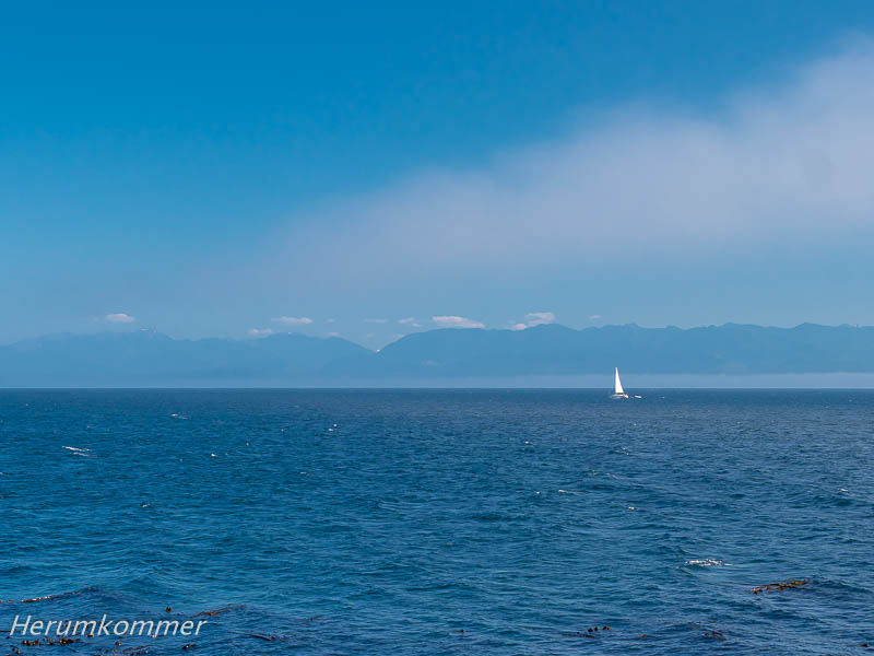
In Victoria on the southeastern tip of Vancouver Island, is kilometer zero of the Trans Canada Highway. However, at the other end of the route, in St. John’s, we saw that there was also counted from 0. Anyway, the main route is 7,821 km long. But we did not drive „just“ across the continent, because we want to see as much of Canada as possible. And so we have already covered around 15,000 km here. The capital of British Columbia is a really pretty city with a British flair, but we are drawn to nature, for which Vancouver Island is famous. Near Sooke, on the south coast of the island, the Sooke River has washed the Sooke Potholes out of the rock. These pools, surrounded by the forest of the famous giant trees, are a popular bathing area in summer. An der Südküste von Vancouver Island, am Sheringham Point westlich von Sooke, soll es einen schönen Leuchtturm geben. Wir fahren die kurvenreiche Schotterstraße durch dichten Wald bis zum Parkplatz, an dem ein kurzer Wanderweg zum Turm beginnt. Der Herumkommer macht sich auf den Weg und entdeckt Ungewöhnliches: Der Leuchtturm ist in eine weiße Folie eingepackt, wie zum Versand. Ein Schild klärt auf, dass er renoviert wird. Die Felsenküste beim Turm ist sehenswert und am Horizont sind die Berge im US-Bundesstaat Washington zu sehen. Über dem Meer zieht Hochnebel auf.
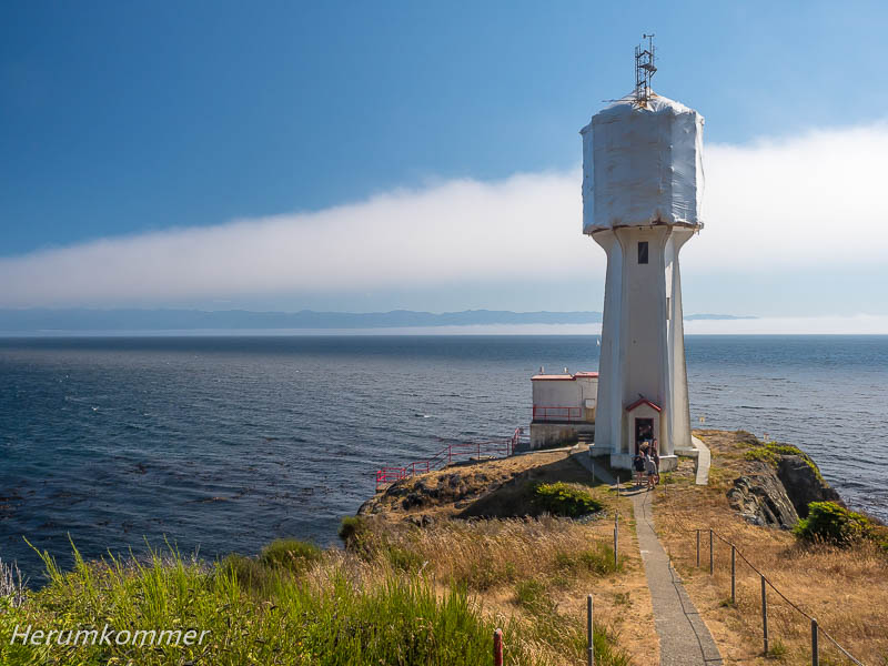
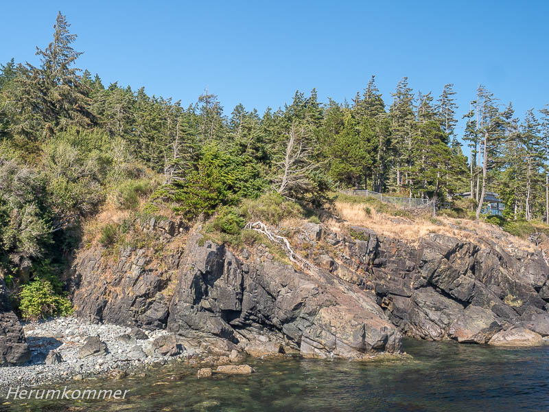
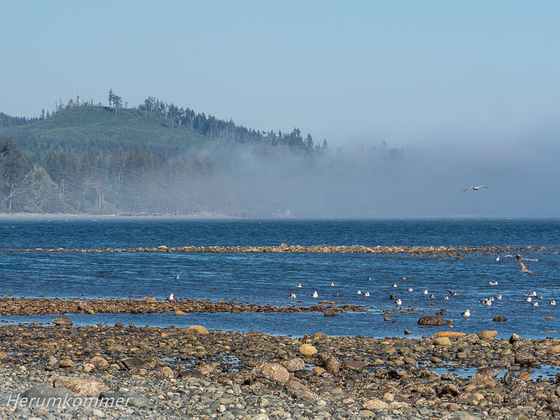
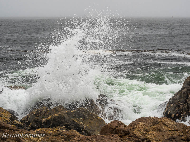
Fog coast On the south coast of Vancouver Island, at Sheringham Point west of Sooke, accordingly there is a nice lighthouse. We drive the winding gravel road through dense forest to the parking lot, where a short trail to the tower begins. The Aroundgetter makes his way and discovers something out of the ordinary: the lighthouse is wrapped in a white foil, as if for shipping. A sign explains that it is being renovated. The rocky coastline near the tower is worth seeing and on the horizon you can see the mountains in the US state of Washington. Over the sea, high fog lifts up. Wir fahren weiter nach Westen, bei Jordan River entdecken wir einen pittoresken, steinigen Strand. Innerhalb weniger Minuten zieht hier der Nebel an die Küste. Dies Phänomen kommt an der ganzen Süd- und Westküste der Insel häufig vor.
We continue west, at Jordan River we discover a picturesque stony beach. Within a few minutes, the fog pulls to the coast. This phenomenon is common on the whole south and west coast of the island. Kurz vor der Mündung des River Jordan in den Pazifik vor der Südküste von Vancouver Island bei Jordan River werden Baumstämme zu Flößen zusammengestellt. Offensichtlich sollen die über das Meer geflößt werden. Mit zwei sehr kleinen, robusten und extrem wendigen Booten werden die Stämme zu Bündeln zusammen geschoben und dann vertäut.
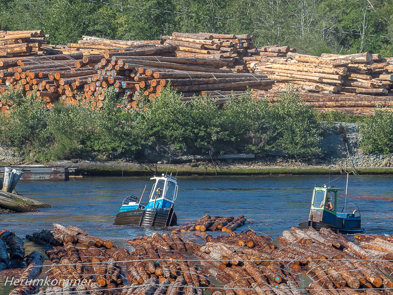
Timber rafts Shortly before the mouth of the River Jordan in the Pacific off the south coast of Vancouver Island at Jordan River tree trunks are assembled into rafts. Obviously, they are to be floated over the sea. With two very small, robust and extremely agile boats, the logs are pushed together in bundles and then moored. Kanada ist ein Kaffeeland, Tee gibt es fast ausschließlich in Teebeuteln. Tee mit nennenswertem Teegeschmack ist hier eine Rarität. Umso erfreuter sind wir, als wir in der Tourismus-Broschüre der Region Cowichan auf Vancouver Island lesen, dass hier Kanadas einzige Teefarm ist. Sie liegt etwas versteckt aber wir finden die Westholme Tea Company in der Nähe von Duncan. Es ist keine große Plantage, aber ein geschmackvoll eingerichtetes Cafe mit Shop und ein üppig gestalteter kleiner Park mit Gartenterrasse. Als die Inhaberin mitbekommt, dass wir aus Deutschland sind, spricht sie uns auf deutsch an. Sie ist aus Dänemark. Nun sind wir auch nicht mehr erstaunt über das gediegen gemütliche skandinavische Ambiente. Und in den nächsten Wochen können wir den köstlichen Bio-Tee genießen.
Canada‘s tea farm Canada is a coffee country, tea is available almost exclusively in teabags. Tea with a considerable tea taste is a rarity here. We are all the happier when we read in the tourism brochure of the Cowichan region on Vancouver Island that here is Canada’s only tea farm. It is a bit hidden but we find the Westholme Tea Company near Duncan. It is not a large plantation, but an aesthetic decorated cafe with shop and a lushly landscaped little park with garden terrace. When the owner notices that we are from Germany, she speaks to us in German. She is from Denmark. Now we are no longer surprised by the elegant, cozy Scandinavian ambience. And in the next few weeks we can enjoy the delicious organic tea. Tofino und Ucluelet an der Westküste von Vancouver Island sind so etwas wie die westlichen Außenposten Kanadas. Wir fahren zuerst nach Ucuelet und an dessen äußerstes Ende. Hier am Amphitrite Point steht ein etwas ungewöhnlicher Leuchtturm in den zackigen Felsen. Die Küste ist mal wieder in Nebel gehüllt.
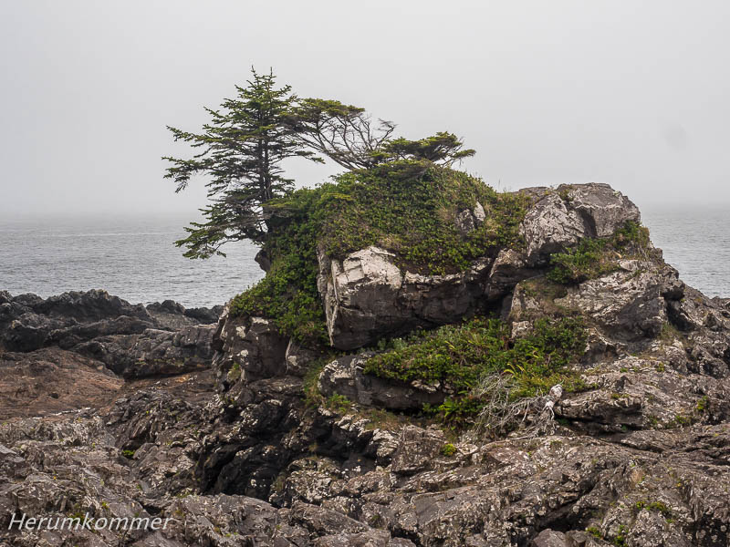
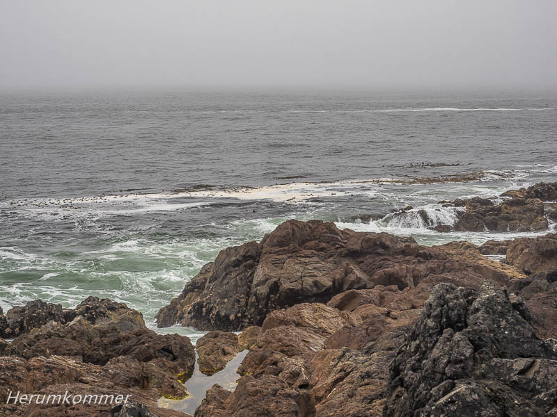
Tofino and Ucluelet on the west coast of Vancouver Island are like the western outposts of Canada. We drive first to Ucuelet and to its extreme end. Here at Amphitrite Point stands a somewhat unusual lighthouse in the jagged rocks. The coast is once again shrouded in fog. Durch Tofino drehen wir nur eine Runde und sind wieder weg. Der Ort liegt schön am Meer, aber er ist fest in der Hand der Tourismusindustrie. Sehen – und mehr noch – gesehen werden ist hier wichtig. Kein Ort an dem wir uns wohlfühlen. Aber im nahe gelegenen Pacific Rim National Park entdecken wir bei einem Abstecher von der Hauptstraße einen zauberhaften Naturwald und die hübsche Grice Bay.
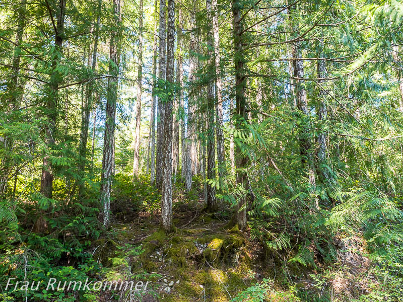
Through Tofino we only make one round and are gone again. The place is beautifully situated by the sea, but it is firmly in the hands of the tourism industry. Seeing – and even more – being seen is important here. Not a place where we feel comfortable. But in the nearby Pacific Rim National Park, a detour off the main road, we discover a magical natural forest and the pretty Grice Bay. Auf der Fahrt quer über Vancouver Island zur Westküste haben wir in den Bergen einen Übernachtungsplatz gesucht. Einige Kilometer westlich von Port Alberni sind wir auf einer extrem holprigen Dirt Road abwärts durch den Wald gefahren. Nach ein paar hundert Metern haben wir den Sproat Lake erreicht. Hier stehen in Nischen im Wald und an breiteren Passagen des Uferwegs einige Camper, Wohnwagen und PKW. Einer fährt gerade weg und macht einen besonders schönen Platz für uns frei, unmittelbar am Seeufer. Und weil dieser Ort so romantisch ist, nutzen wir ihn auf der Rückfahrt zur Ostküste nochmal.
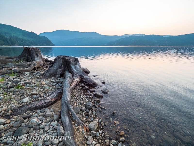
On the tour across Vancouver Island to the west coast, we looked for a place to stay in the mountains. A few kilometers west of Port Alberni we drove down an extremely bumpy dirt road through the forest. After a few hundred meters we have reached the Sproat Lake. There are some campers, caravans and cars in niches in the forest and at broader passages of the lakeside path. One is just leaving and makes a particularly beautiful place for us, right on the shores of the lake. And because this place is so romantic, we use it again on the way back to the east coast. Bei Errington, südlich von Parksville, liegt in einen Provincial Park eingebettet ein Wasserfall, den wir sehen wollen. Es ist schwülheiß, aber der Weg vom Parkplatz durch den Wald ist nicht weit. Der Englishman River führt nur wenig Wasser und das fließt hinter einem großen Felsbrocken hindurch. Der Wasserfall ist daher enttäuschend, aber der Wald hat den Weg gelohnt.
Near Errington, south of Parksville, nestled in a Provincial Park is a waterfall we want to see. It is muggy hot, but the way from the parking lot through the forest is not far. The Englishman River carries little water and that flows behind a large boulder. The waterfall is therefore disappointing, but the forest has paid off. In der Mitte von Vancouver Island liegt der ausgedehnte Strathcona Provincial Park. Er ist überwiegend geprägt von rauer, bergiger Wildnis. An einem der heißesten Tage dieses Sommers ist es uns selbst an den Seen im Park zu warm für mehr als kurze Spaziergänge. Die berühmten riesigen Bäume der Insel sehen hier aus, als wären sie behaart. Flechten gedeihen nämlich prächtig in dem feuchten, milden Klima. Abends haben wir einen idyllischen Stellplatz mit romantischen See-Impressionen.
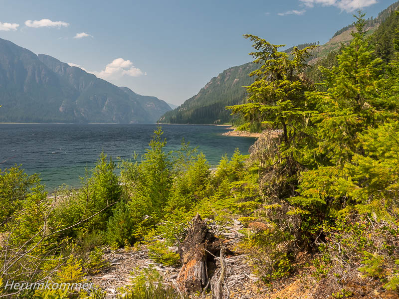
In the middle of Vancouver Island lies the sprawling Strathcona Provincial Park. It is predominantly characterized by rough, mountainous wilderness. On one of the hottest days of this summer, it is too warm for us to walk by the lakes in the park for more than short walks. The island’s famous giant trees look like they’re hairy. Lichens thrive splendidly in the humid, mild climate. In the evening we have an idyllic pitch with romantic lake impressions. Vor der Küste von British Columbia liegt eine Kette von Inseln, die eine Schiffspassage vor dem offenen Pazifik schützt. Eine Schiffsreise durch die Insel- und Fjordlandschaft dieser Inside Passage gilt als eine Top-Attraktion in Kanada. Sechzehn Stunden dauert die Fahrt zwischen Port Hardy auf Vancouver Island und Prince Rupert, südlich des so genannten Pfannenstiel von Alaska. Wir können sie nicht einfach buchen. Bei BC Ferries, der Fährgesellschaft, haben wir online ein Formular ausgefüllt mit einem Wunschtermin und einem Alternativtermin. Zwei Tage später wurde uns per E-Mail mitgeteilt, dass wir auf der Warteliste sind. Acht Tage nach Antrag können wir tatsächlich starten. Wir können auf dem Gelände des Fährterminal in Port Hardy übernachten, denn es geht früh los. Um 5 Uhr sollen die Fahrzeuge bereitstehen, um 7:30 Uhr startet das Schiff, eine moderne Fahrzeugfähre, gebaut auf einer Werft in Flensburg. Die ersten Stunden fahren wir durch mehr oder weniger dichten Nebel. Etwa nach der Hälfte der Strecke, beim Zwischenstopp in Bella Bella, hat sich der Nebel gelichtet. Ankunft in Prince Rupert ist kurz vor Mitternacht.
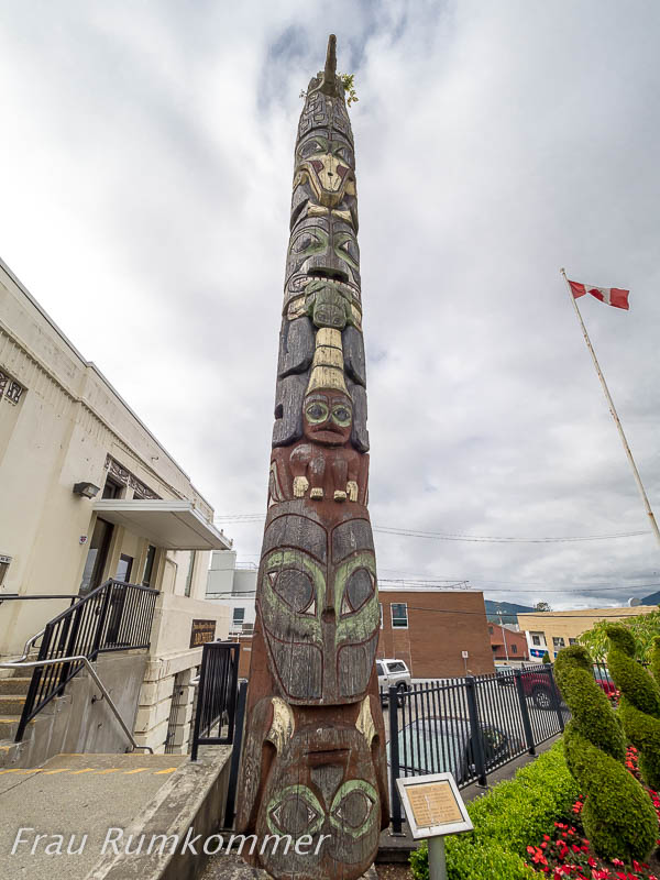
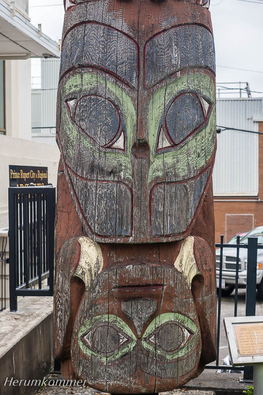
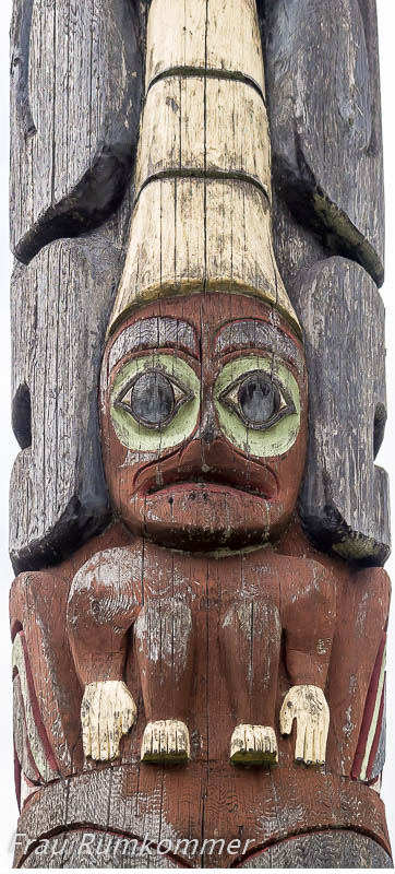
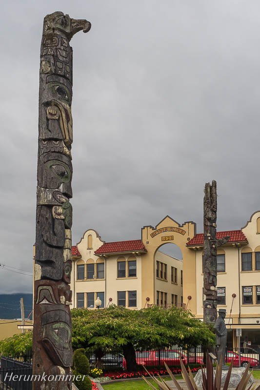
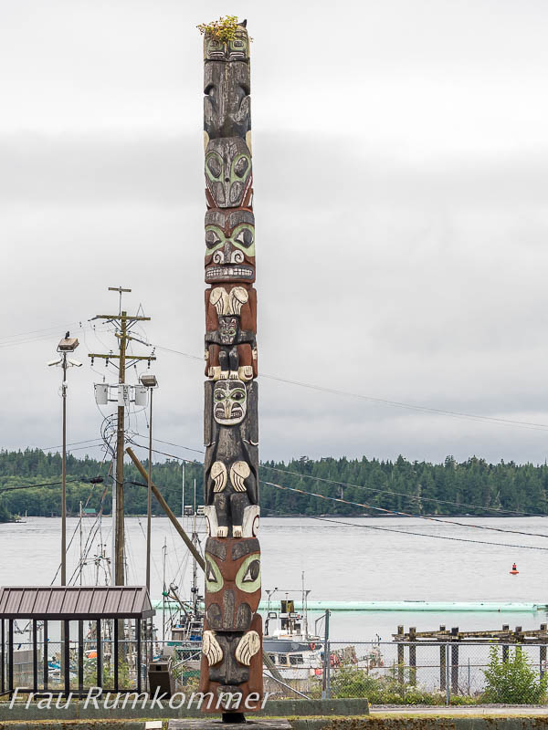
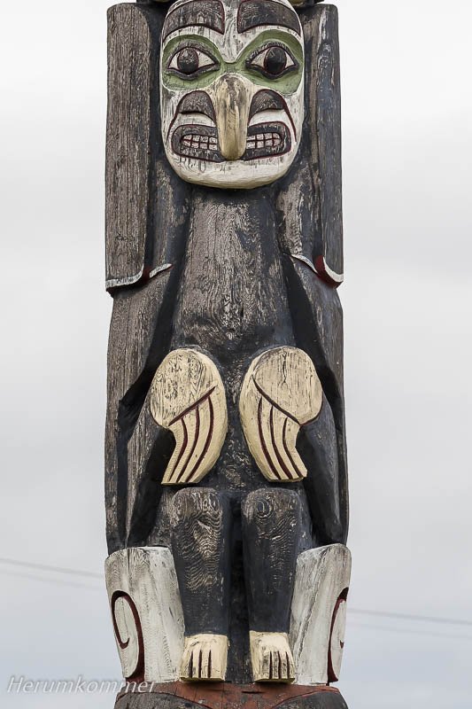
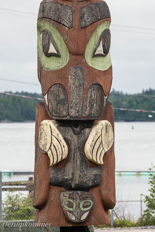
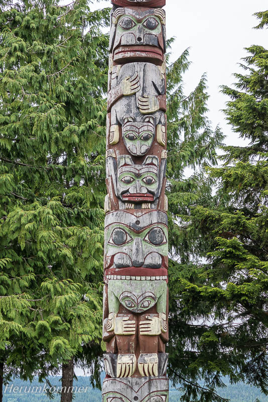
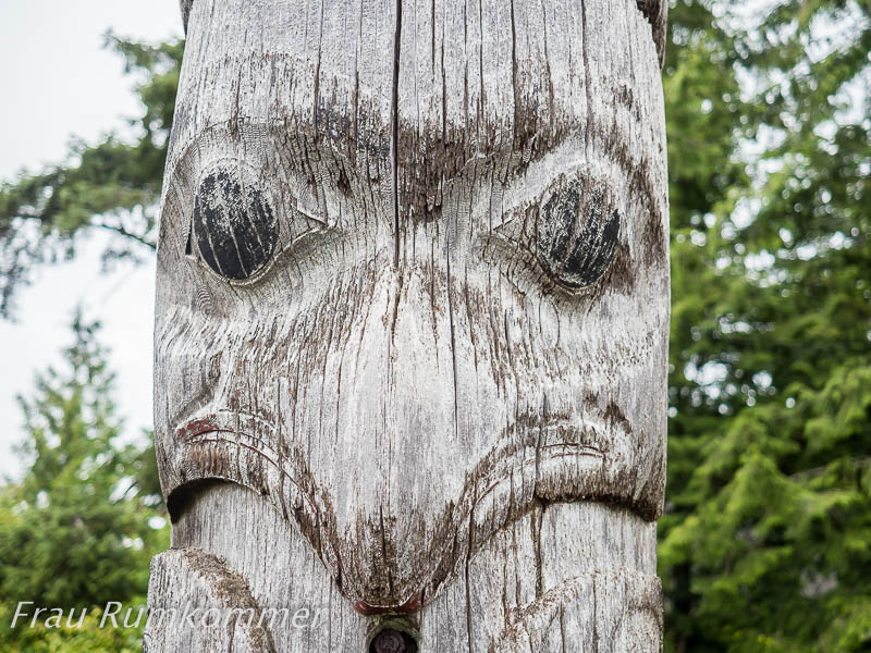
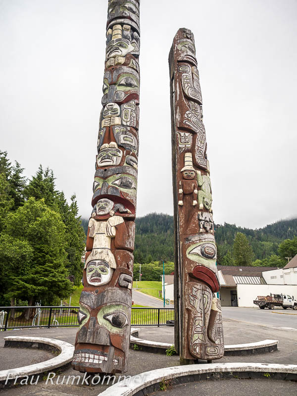
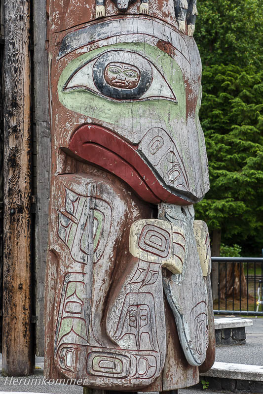
Along the coast of British Columbia lies a chain of islands that protects a ship passage from the open Pacific. A voyage through the islands and fjord landscape of this Inside Passage is considered a top attraction in Canada. It takes sixteen hours between Port Hardy on Vancouver Island and Prince Rupert, south of Alaska’s Panhandle. We can not just book it. At BC Ferries we have filled out a form online with a desired date and an alternative date. Two days later we were informed by email that we are on the waiting list. Eight days after application, we can actually start. We can stay overnight at the Port of Hardy ferry terminal because the start is early. At 5 o’clock the vehicles should be ready, at 7:30 the ship starts, a modern vehicle ferry, built on a shipyard in Flensburg in northern Germany. The first hours we sail through more or less dense fog. About half way, at the stopover in Bella Bella, the fog has cleared. Arrival at Prince Rupert is shortly before midnight. Um 23:30 Uhr kommen wir in Prince Rupert an, nach einem sehr langen Tag. Einen Stellplatz für die Nacht zu finden, ist jetzt nicht einfach. In der ganzen Stadt finden wir keine Möglichkeit. Jeden zweiten Abend kommen mit der Fähre aus Port Hardy einige Wohnmobile, also steht an praktisch allen geeigneten Plätzen in der Stadt ein entsprechendes Verbotsschild. An der Stadtgrenze, an der Straße nach Terrace, finden wir schließlich einen kleinen Park mit Parkplatz ohne Verbot. Hier verbringen wir den Rest der Nacht in Ruhe. Rund die Hälfte der Einwohner von Prince Rupert sind Angehörige der First Nations. Ihnen erweist die besonderen Respekt und hat in der gesamten Innenstadt, sogar am Rathaus, eine beachtliche Sammlung von Totems aufgestellt. Wir sind beeindruckt und zeigen hier eine kleine Auswahl:
At 11:30 pm we arrive at Prince Rupert after a very long day. Finding a pitch for the night is not easy now. In the whole city we find none. Every second evening some motorhomes arrive with the ferry from Port Hardy, so there is a corresponding prohibition sign at practically all suitable places in the city. At the city limits, by the road to Terrace, we finally find a small park with parking without a ban. Here we spend the rest of the night in peace. About half of Prince Rupert’s residents are First Nations. The town shows special respect to them and has set up a remarkable collection of totems throughout the city, even at the town hall. We are impressed and show a small selection here: Die Straße von Prince Rupert nach Terrace wird als eine der schönsten Touristenrouten der Welt gepriesen. Sie verläuft praktisch in voller Länge wenige Meter vom Skeena River entfernt. Der wirkt wie ein Fjord, breit und von hohen Bergen eingerahmt. Wo mehr Platz ist, mäandert er. Sein Wasser, wie das seiner Zuflüsse, ist grün bis aquamarin.
At the Skeena River The road from Prince Rupert to Terrace is touted as one of the most beautiful tourist drives anywhere in the world. It runs virtually full length a few meters away from the Skeena River. The Skeena looks like a fjord, wide and framed by high mountains. Wherever there is more space, it meanders. Its water, like that of his tributaries, is green to aquamarine. In Prince Rupert waren wir beeindruckt von den Totems, die dort aufgestellt sind. Aber was wir in Gitanyow (oder Kitwanga) sehen, ist Ehrfurcht gebietend. In dem kleinen First Nations – Ort, gut hundert Kilometer nördlich von Terrace, steht eine Sammlung von zwanzig besonders großartigen Totems. Es ist kaum möglich, sich der Magie des Ortes zu entziehen, obwohl diese Kunstwerke, wie wir hier erfahren, keine religiöse Bedeutung haben. Und den Parkplatz des Convenience Store, zwischen den Totems, dürfen Camper als kostenlosen Übernachtungsplatz nutzen.
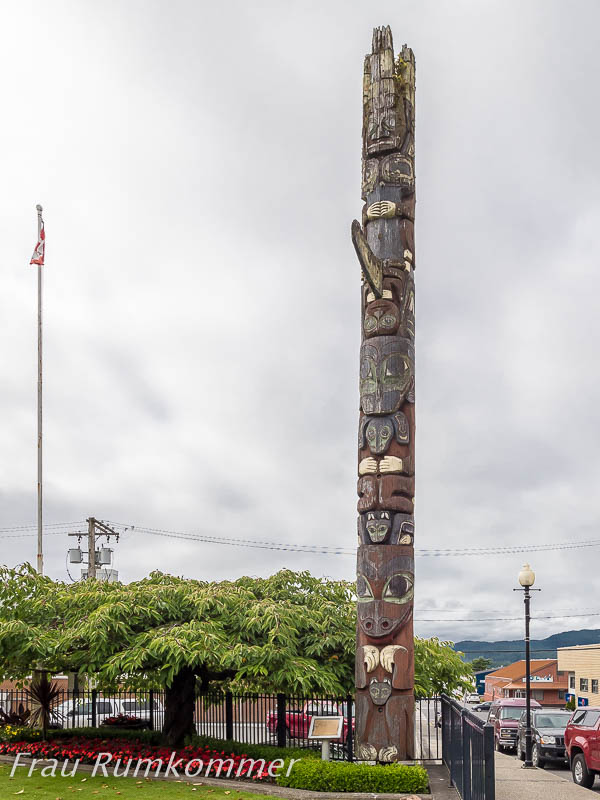
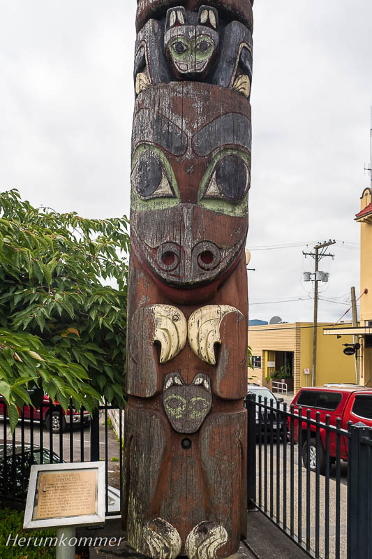
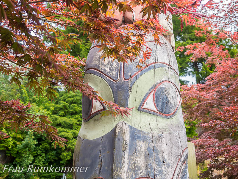
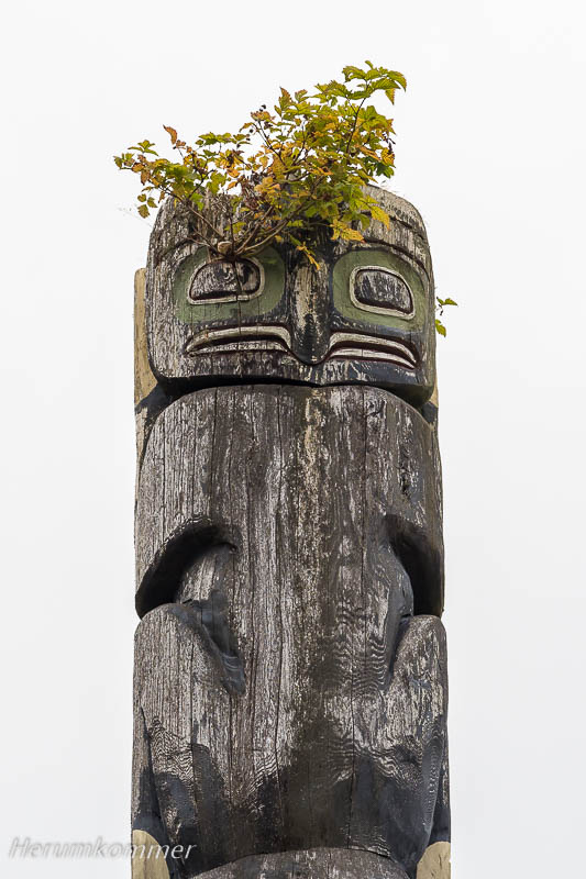
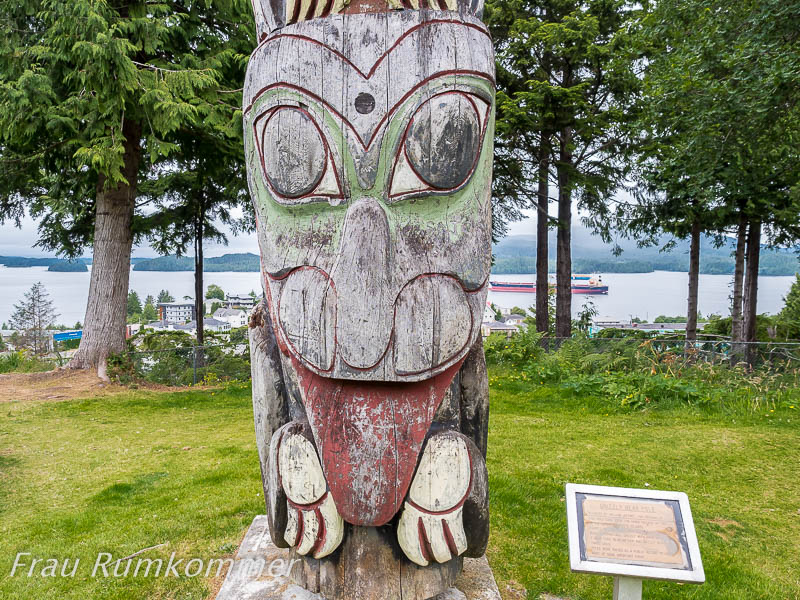
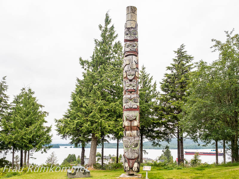
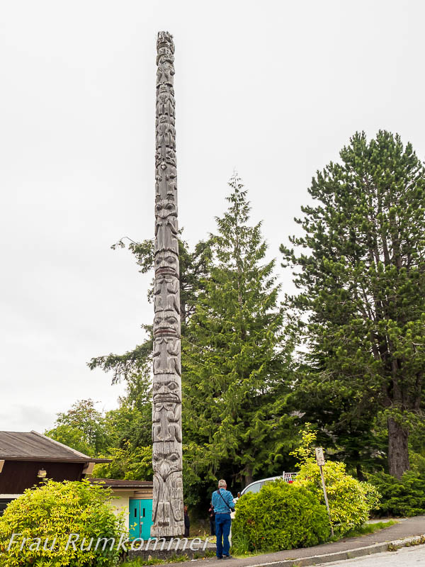
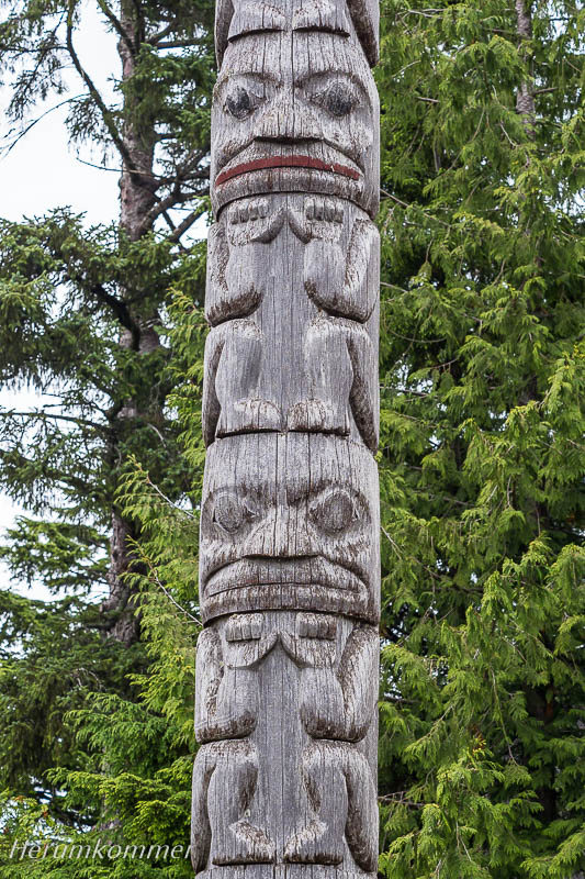
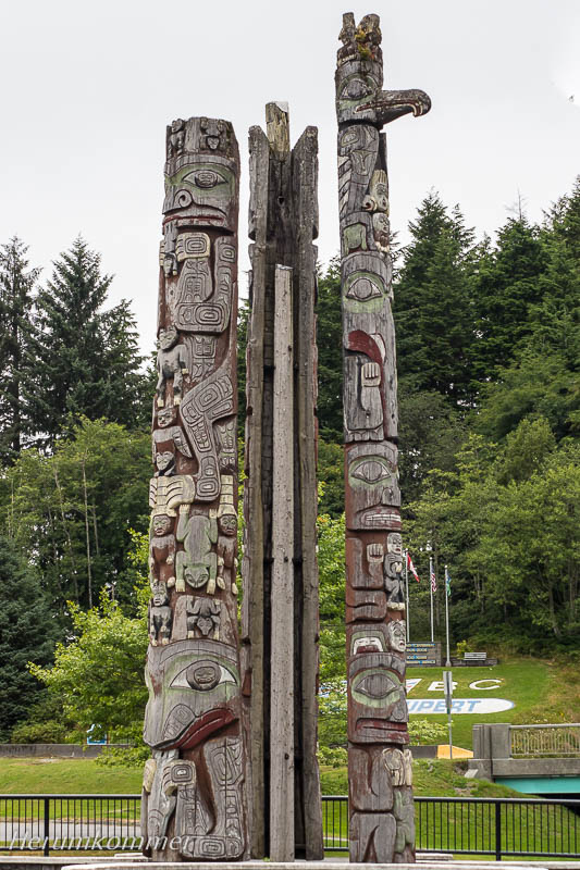
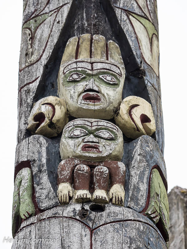
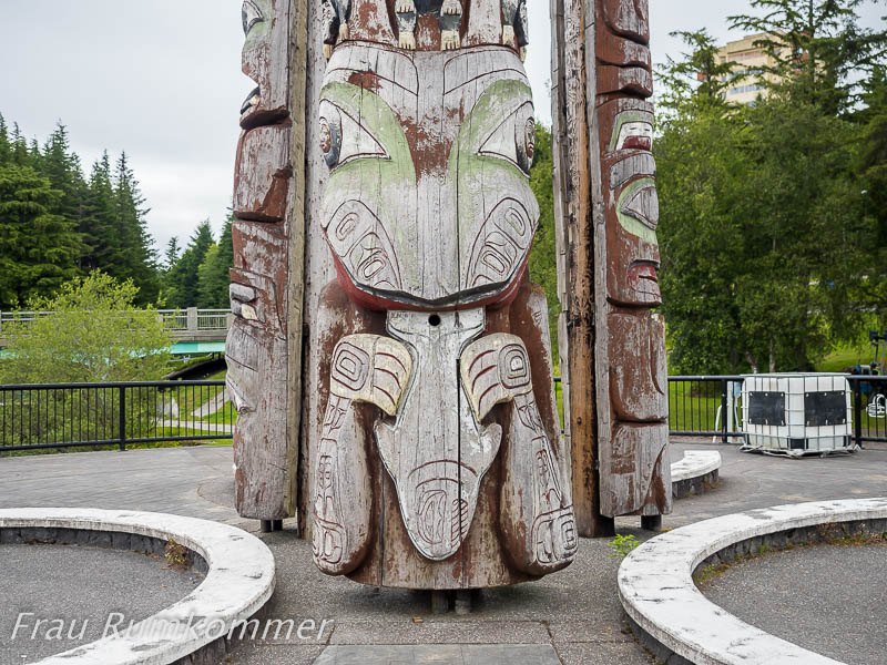
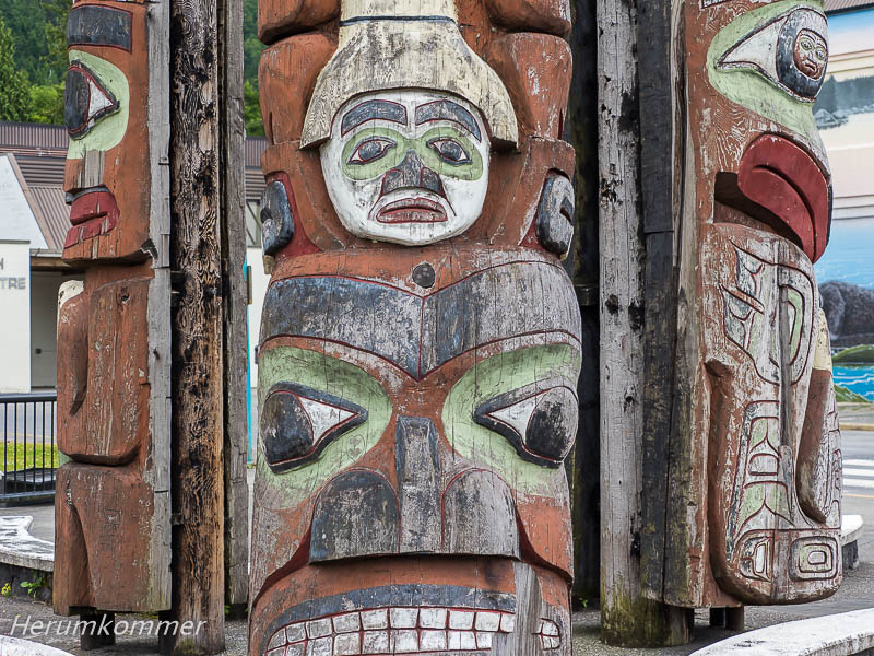
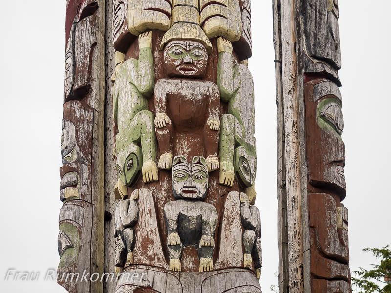
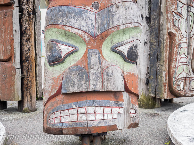
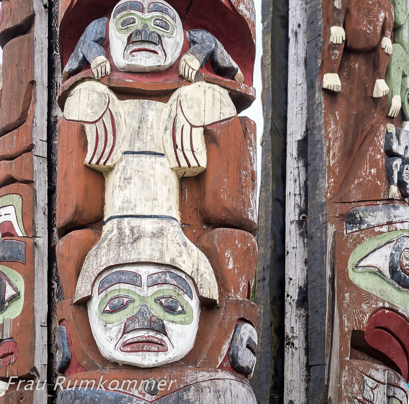
At Prince Rupert we were impressed by the totems that are placed there. But what we see in Gitanyow (or Kitwanga) is awe-inspiring. In the small First Nation village, just over a hundred kilometers north of Terrace, there is a collection of twenty very great totems. It is hardly possible to escape the magic of the place, although these works of art, as we learn here, have no religious significance. And the parking lot of the Convenience Store, between the totems, campers are allowed to use as a free overnight stay. Canada’s west in summer
Gefundenes Fressen


Nach Vancouver Island


Tsartlip Health Station


Sculpture Walk


Romantik in Oak Bay


Sooke Potholes


Nebelküste


Holzflöße


Kanadas Teefarm


Amphitrite Point


Grice Bay


Sproat Lake


Englishman River Falls


Strathcona Park


Inside Passage


Prince Rupert
Am Skeena River


Gitanyow


