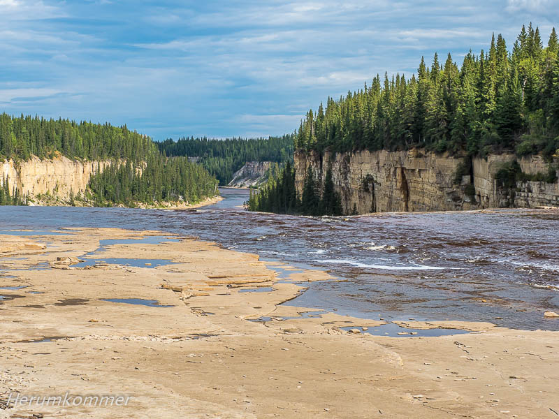
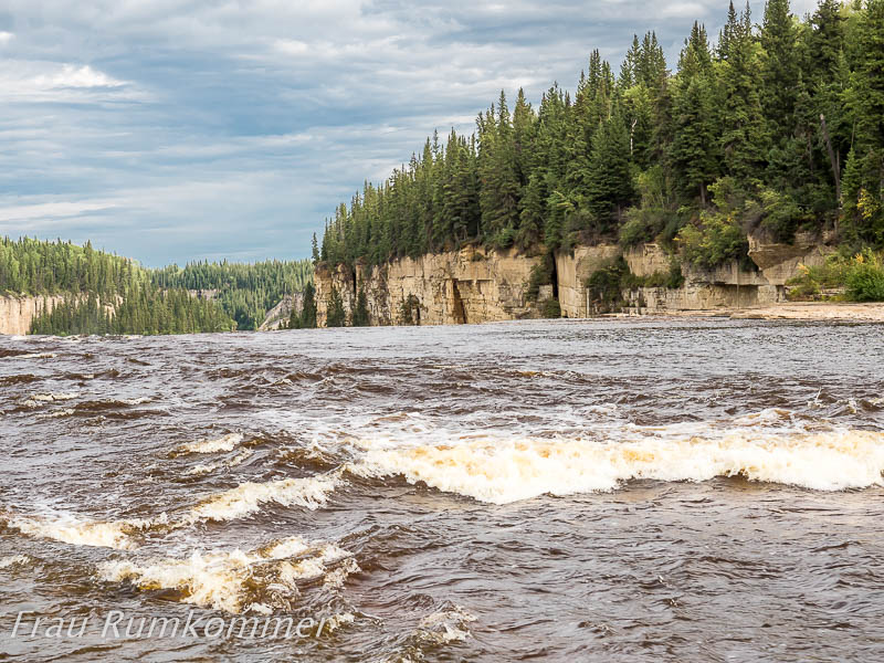
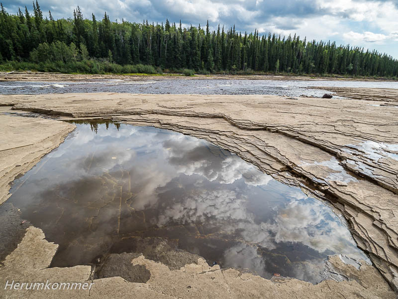
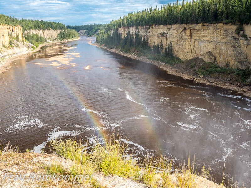
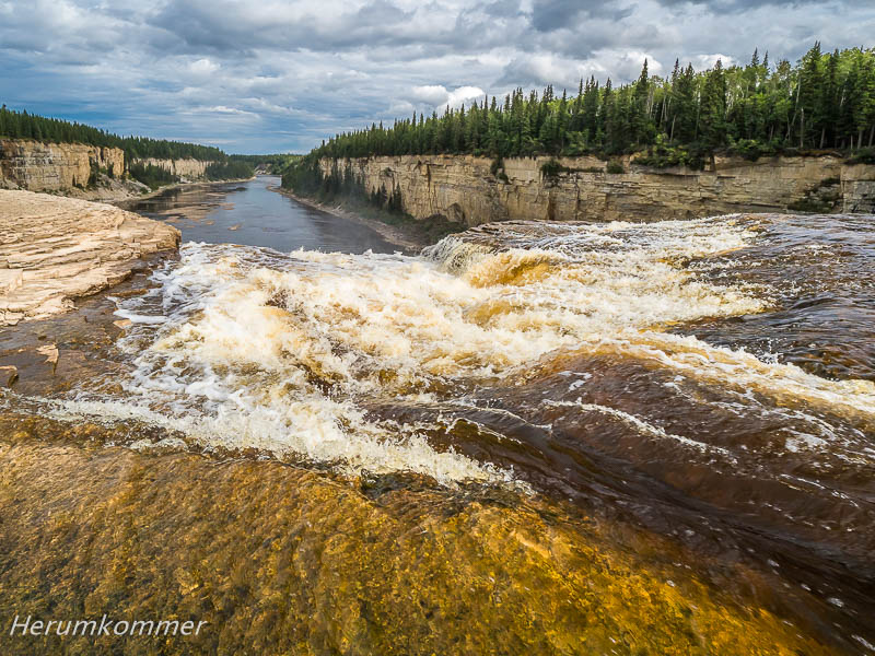
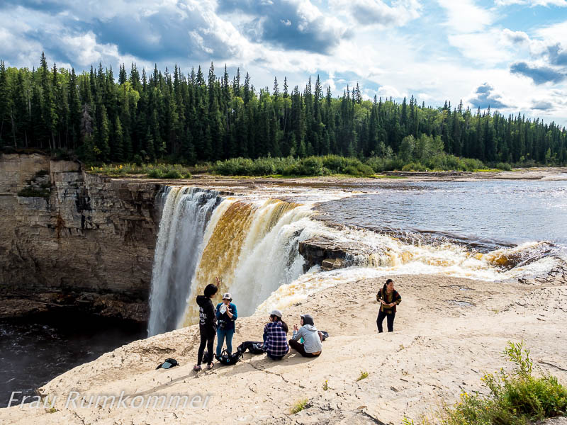
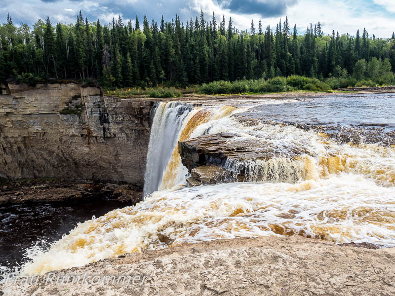
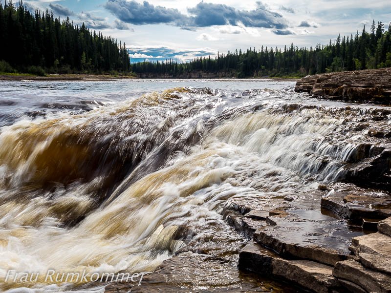
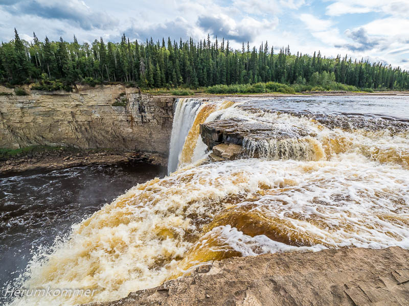
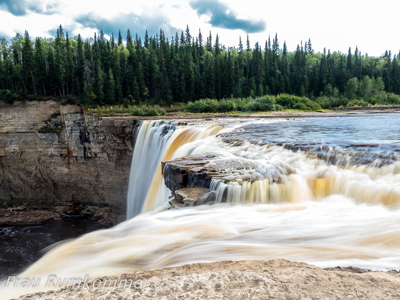
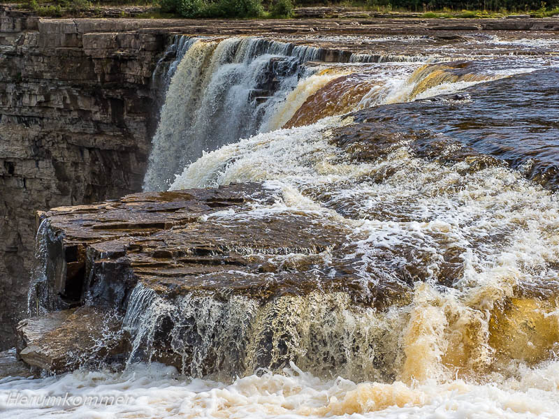
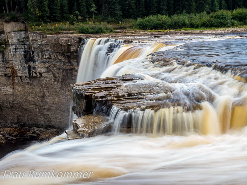
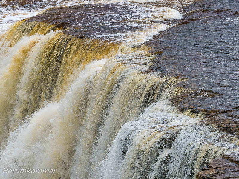
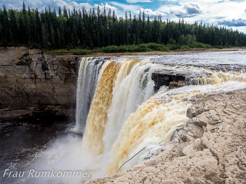
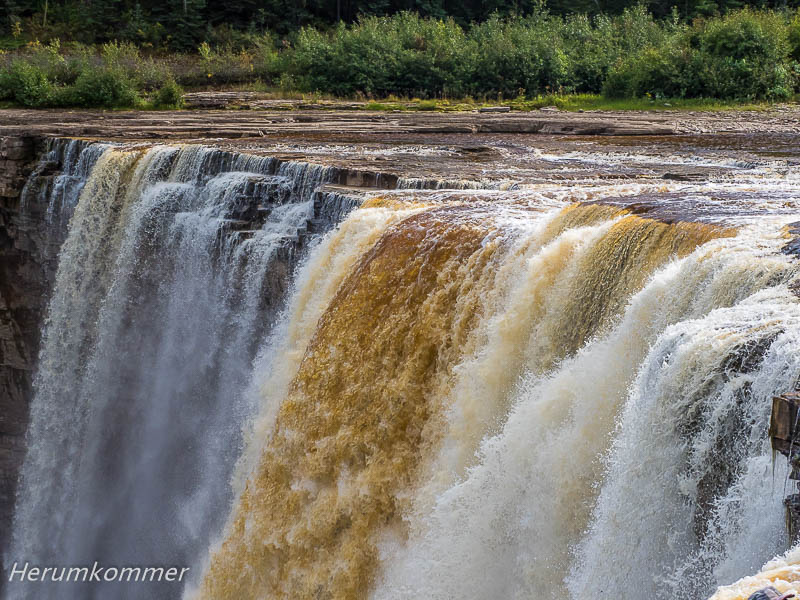
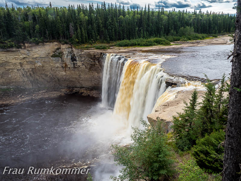
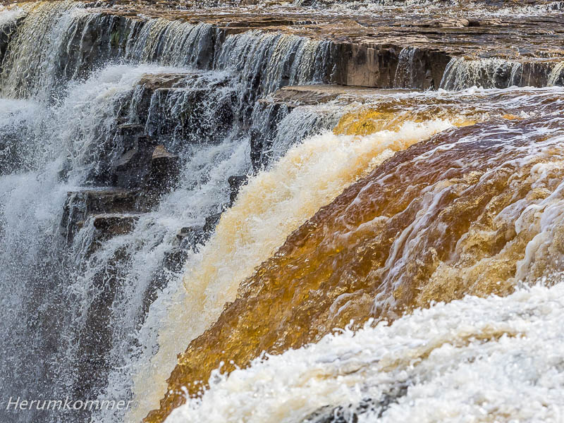
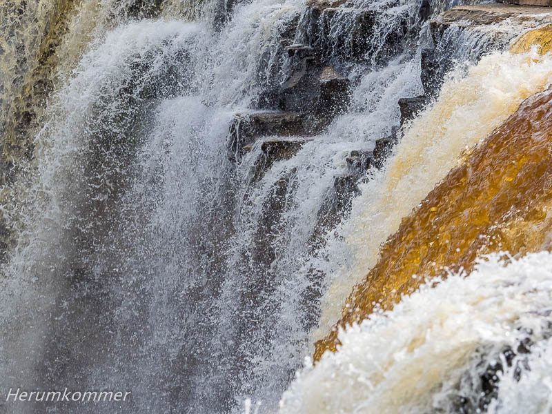
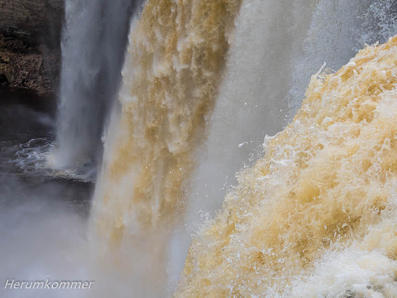
Von den Louise Falls fahren wir nur vier Kilometer weiter flussaufwärts. Dort bildet der Hay River die 32 m hohen Alexandra Falls. Ein paar Meter eine Böschung hinab können wir auf die Felsplattform gehen, über die der Fluss dem Wasserfall entgegen fließt. Wegen des geringen Wasseraufkommens hat er sich vom Ufer weit zurück gezogen. So erhalten wir die Aussicht entlang des Flusses über den Wasserfall hinweg in die Schlucht, die er auch hier ausgewaschen hat. Auf dem flachen Flussbett können wir bis direkt an die Fälle heran.
From the Louise Falls we drive only four kilometers further upstream. There, the Hay River forms the 32 m high Alexandra Falls. A few meters down an embankment we can go on the rock platform over which the river flows towards the waterfall. Because of the low water flow, it has pulled back far from the shore. So we get the view along the river over the waterfall into the ravine, which it washed out here too. On the shallow riverbed we can get right up to the falls.
Der Mackenzie Highway von der Grenze zur Provinz Alberta im Süden bis zum Liard Trail im Norden wird touristisch als ‚Wasserfall-Route‘ vermarktet. An dieser Route liegen außer den Alexandra und Louise Falls auch die McNallie Creek Falls, Lady Evelyn Falls und die Sambaa Dee und Coral Falls.
The Mackenzie Highway from the border of the province of Alberta in the south to the Liard Trail in the north is marketed as ‚Waterfalls Route‘. In addition to the Alexandra and Louise Falls, McNallie Creek Falls, Lady Evelyn Falls and the Sambaa Dee and Coral Falls are on this route.