Dies ist der gesamte Blog der letzten Reise-Abschnitte unserer Kanada-Reise durch mehrere der östlichen Provinzen im Herbst.
Er enthält die Reise durch Ontario entlang der großen Seen, durch Québec, New Brunswick, Prince Edward Island und Nova Scotia von Mitte September bis Mitte November (auf 3 langen Seiten):
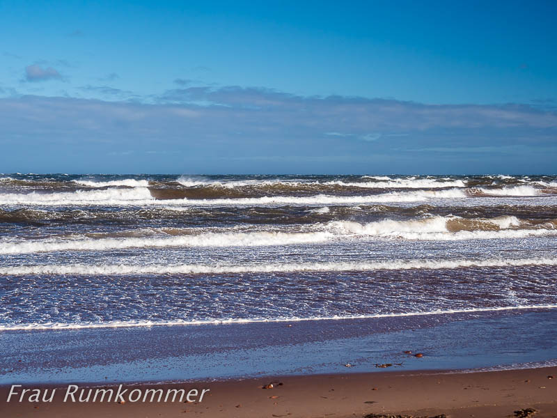
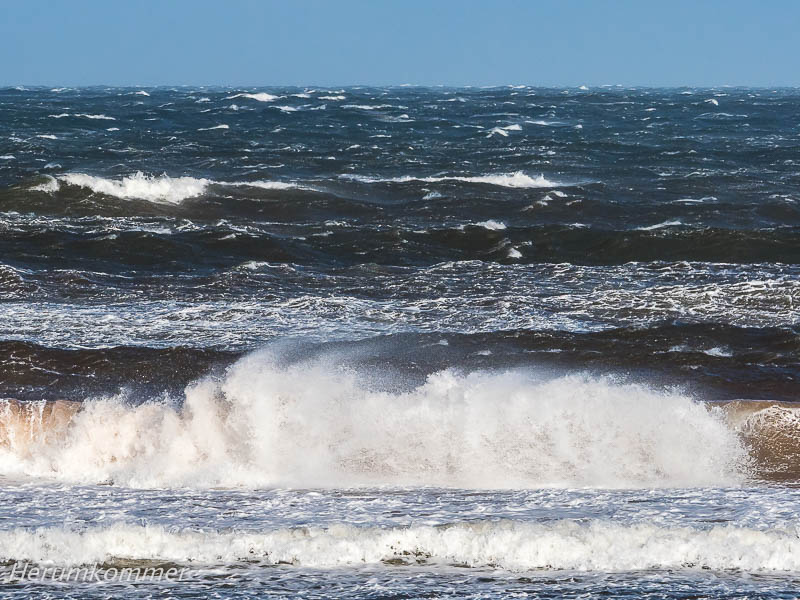
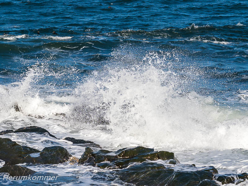
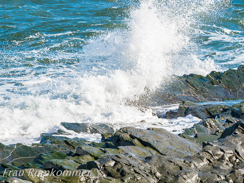
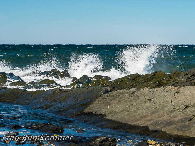
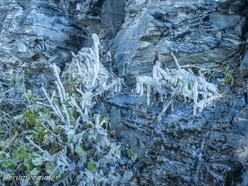
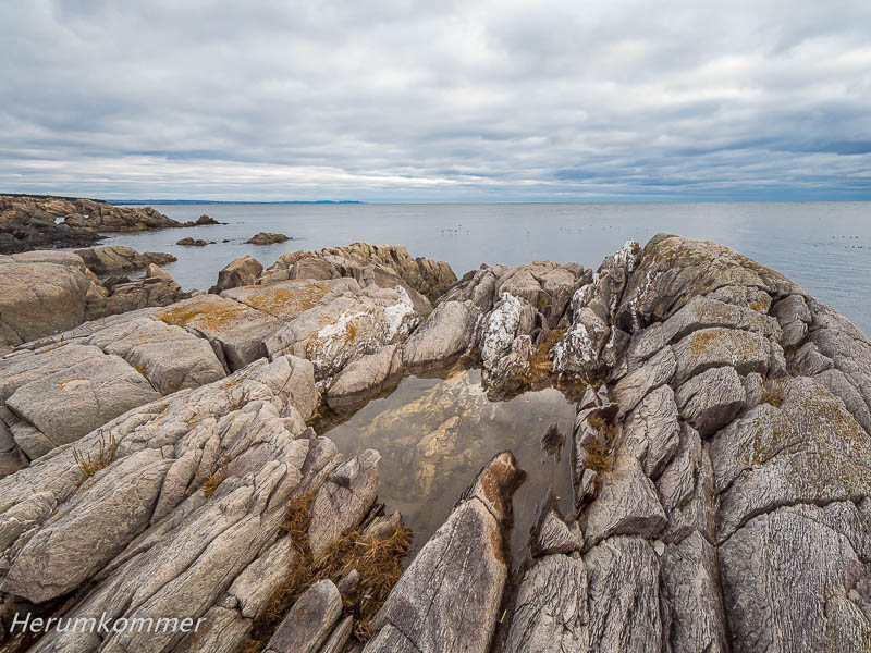
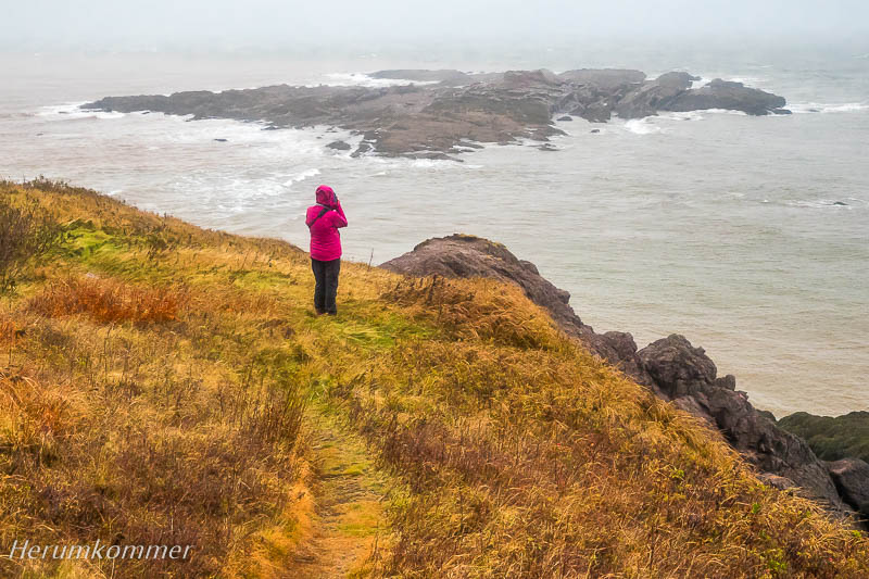
This is the entire blog of the last sections of our Canada trip through several of the eastern provinces in autumn. Die Nordküste der Gaspési ist steil, die Straße ist zum Teil dem Berg oder dem Meer abgerungen. Der Küstenstreifen neben der Straße ist schroff felsig. Einige Passagen der Straße werden von Brechern überspült, sogar bei wenig Wind. An einem Rastplatz „müssen“ wir uns dies Naturschauspiel ansehen Gaspési north coast The northern coast of the Gaspési is steep, the road is partly wrested from the mountain or the sea. The coastal strip next to the road is rugged rocky. Some passages of the road are washed over by breakers, even in low wind. At a rest stop we “have to“ look at this natural spectacle. Während Frau Rumkommer noch mit dem Meer beschäftigt ist, entdeckt der Herumkommer auf der anderen Straßenseite eine Eiswand. Ein Rinnsal läuft die Felswand hinab und der klirrende Frost hat damit kleine Kunstwerke geschaffen.
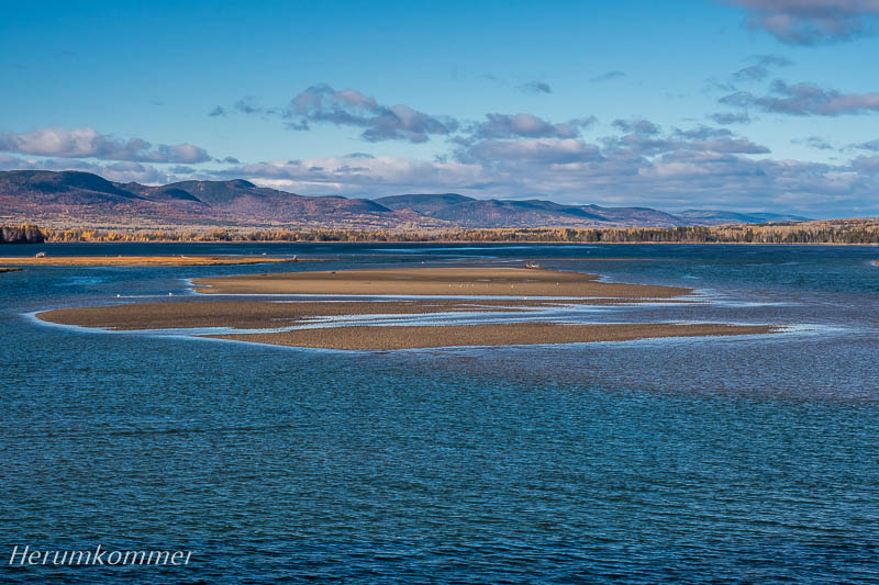
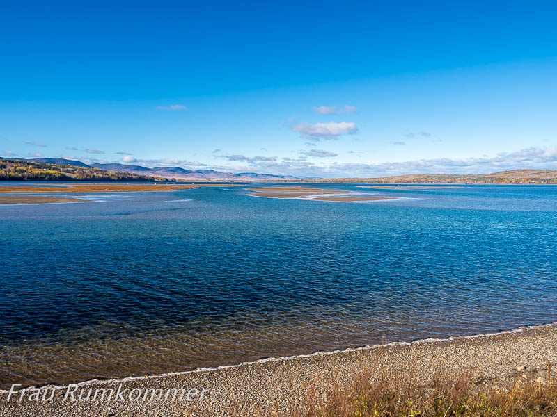
While Mrs. Roundgetter is still busy with the sea, the Aroundgetter discovers an ice wall on the other side of the road. A trickle runs down the cliff face and the freezing cold has created little works of art with it. Am ihrem östlichen Ende hat die Halbinsel Gaspésie eine „Nase“. Dieses „land‘s end“ bildet den Forillon National Park. Im Süden des Parks ist eine Salzwassermarsch vom offenen Meer durch eine lange Nehrung fast abgetrennt. Penouille heißt dieses Gebiet. Der Strand zum Meer hin ist überhäuft mit Treibholz. Zwischen den Treibholz-Haufen und der Marsch ist ein großer, breiter und sehr langer Holzbohlenweg angelegt, auf dem wir erhöht diese ungewöhnlichen Landschaften überblicken.
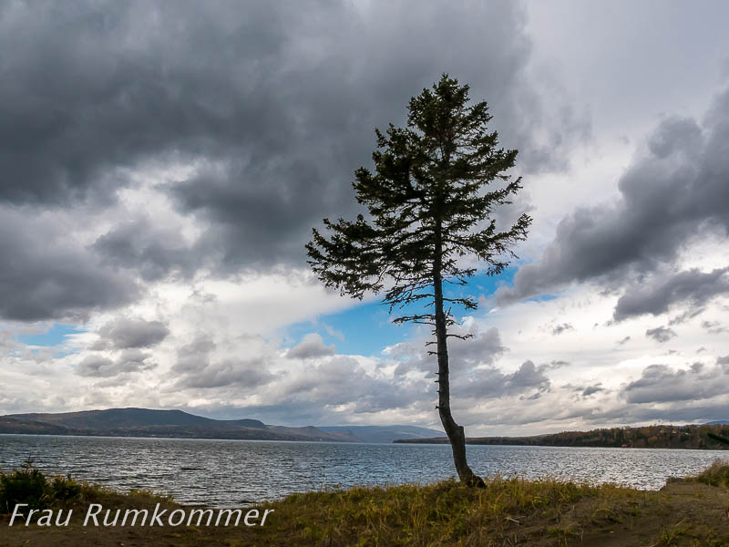
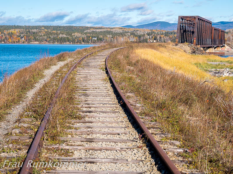
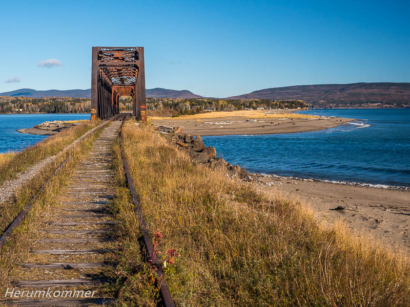
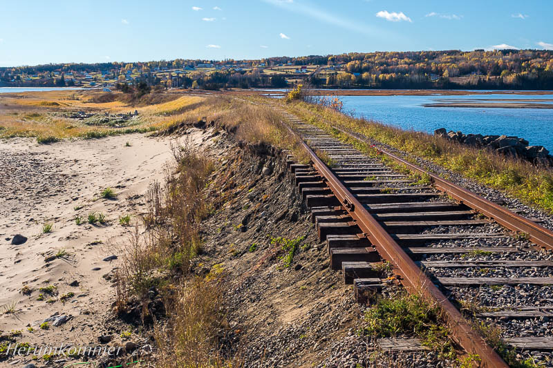
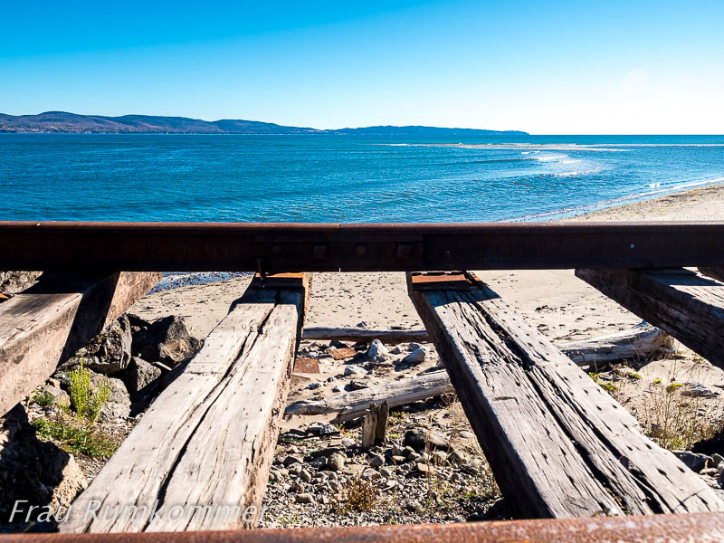
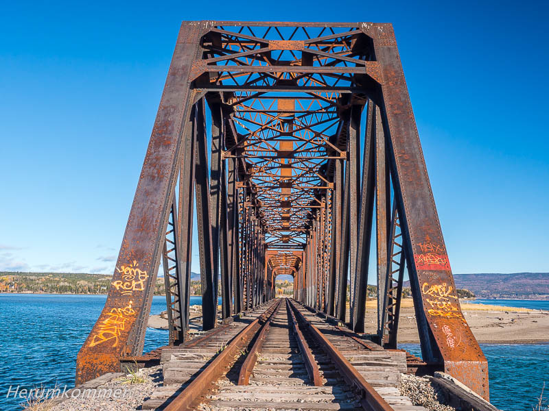
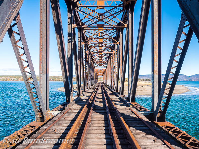
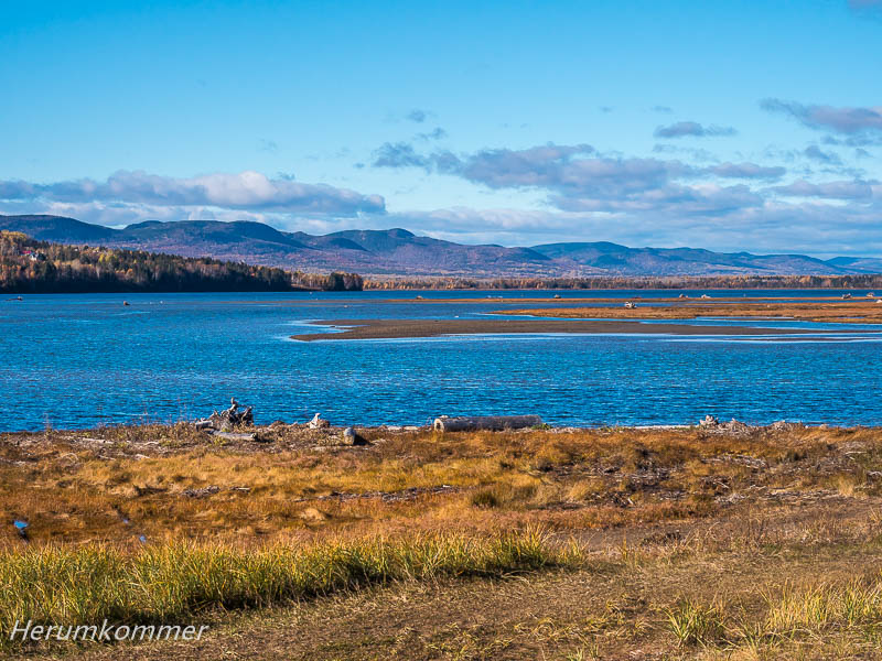
At its eastern end, the Gaspésie peninsula has a „nose“. This „land’s end“ forms the Forillon National Park. In the south of the park, a saltmarch is almost separated from the open sea by a long spit. Penouille is the name of this area. The beach to the sea is covered in driftwood. Between the driftwood pile and the march is a large, wide and very long boardwalk, on which we are surveying these unusual landscapes. In Gaspé, dem Hauptort der Gaspésie, ist es etwas spät geworden und wir sind auf der Suche nach einem „Last-Minute-Übernachtungsplatz“. Bei Douglastown sehen wir von Weitem eine Landzunge, die ins Meer hineinragt. Dort könnte ein geeigneter Platz auf einer Brache sein. Aber Eisenbahnschienen führen über die Landzunge und eine Stahlbrücke. Wenn hier nachts ein Zug fährt, wird es sehr laut. Doch dann sehen wir, dass hier schon lange keine Bahn mehr gefahren ist. Die Schienen sind von Sand und Steinen überspült. Die Brücke ist nicht mehr sehr Vertrauen erweckend. Davor sind die Schienen unterspült. Die Landschaft allerdings, links die Lagune, rechts das Meer, ist traumhaft.
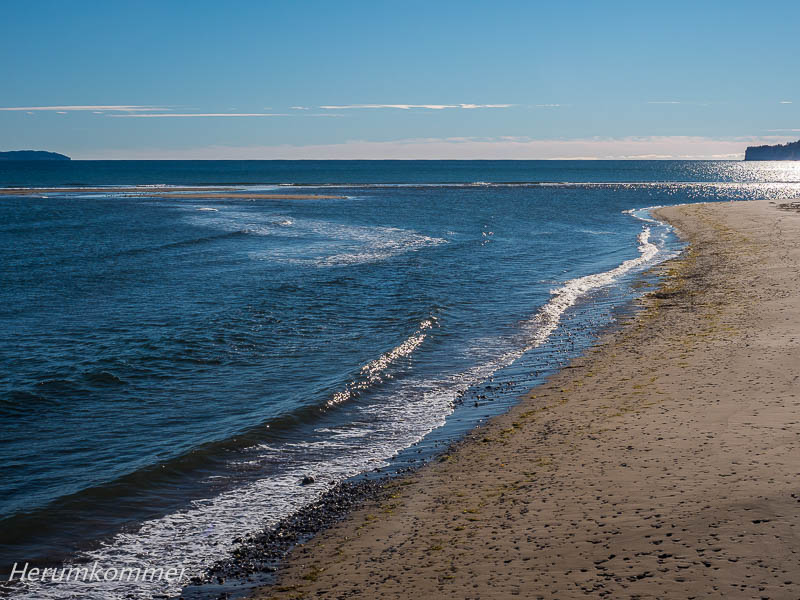
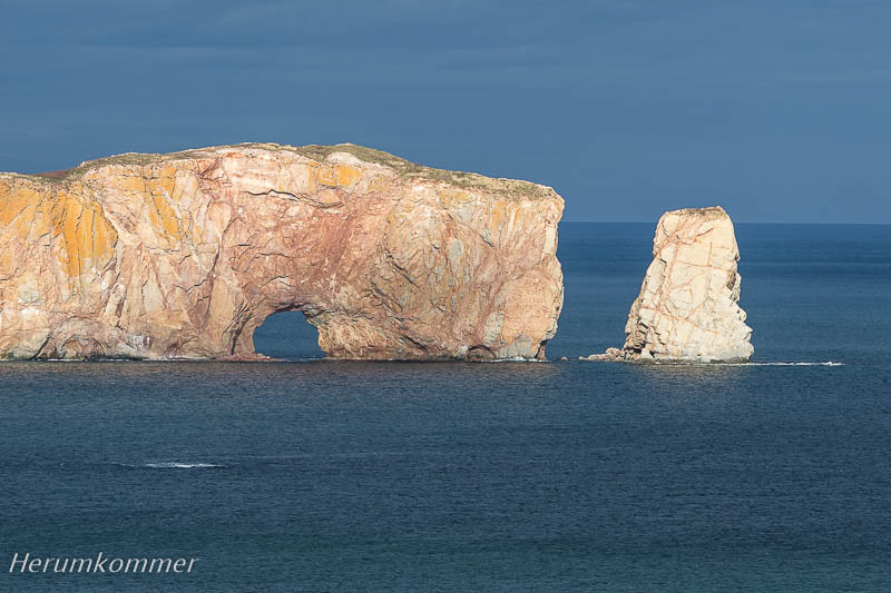
Last minute luck In Gaspé, the main town of the Gaspésie, it has become a bit late and we are looking for a „last minute overnight stay“. Near Douglastown, we see from afar a promontory that juts out into the sea. There could be a suitable place on a fallow land. But a railroad track leads over the headland and a steel bridge. If there is a train here at night, it gets very loud. But then we see that there has not been a train here for a long time. The rails are covered in sand and stones. The bridge is no longer very inspiring. Before it, the rails are undermined. The landscape however, on the left the lagoon, on the right the sea, is fantastic. Wir haben Glück, denn die Attraktion, die im Sommer Percé von Touristen überquellen lässt, liegt an diesem Herbsttag auch in der Sonne: Der Rocher Percé, 5 Mio. t Kalkstein, 88 m hoch, 438 m lang. Die Erosion nagt an ihm und hat einen 20 m hohen Torbogen hindurch gearbeitet. Von einer Infotafel erfahren wir, dass der Felsen in rund 16.000 Jahren vollständig zerbröselt sein wird. Na, das werden wir dann ja sehen!
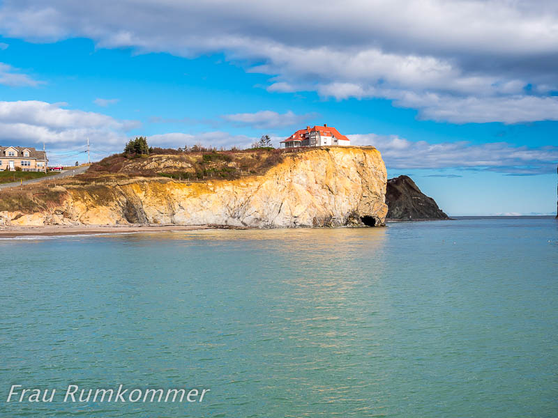
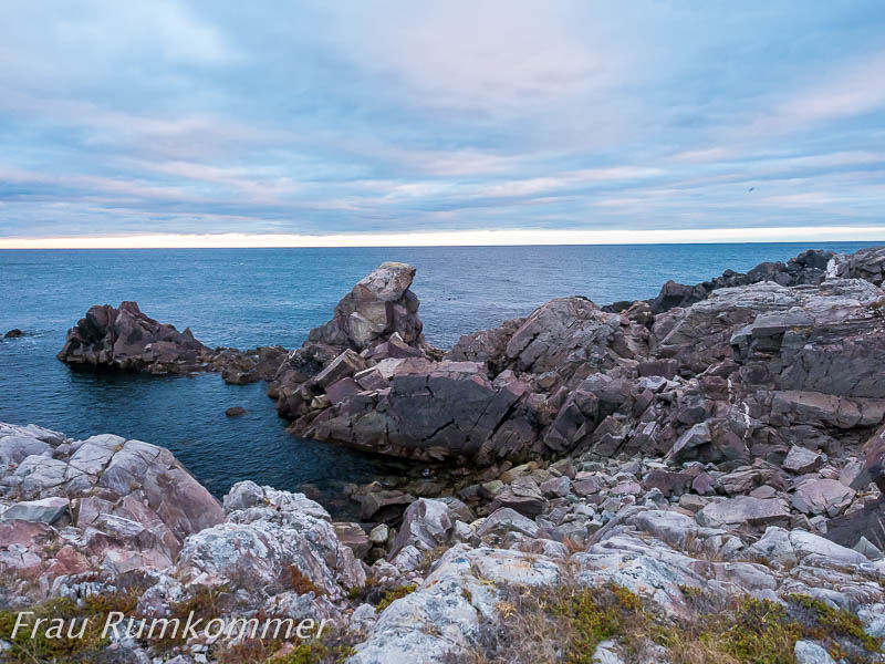
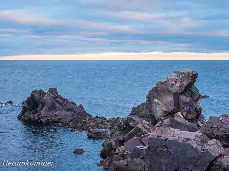
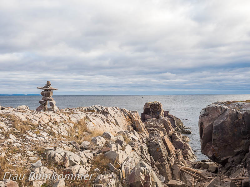
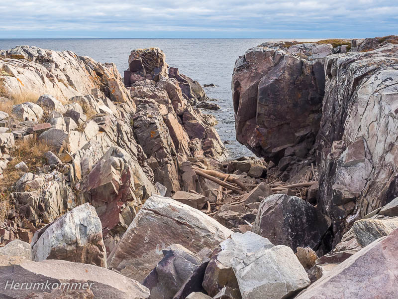
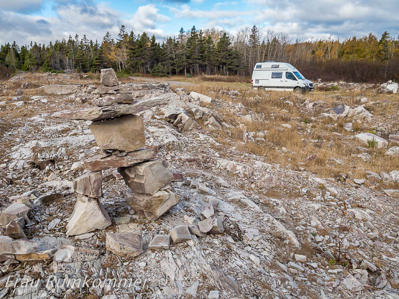
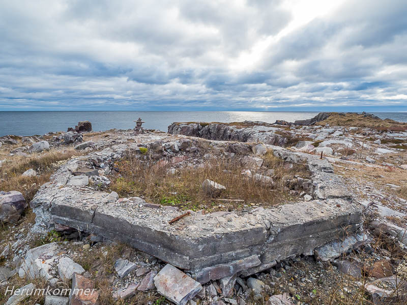
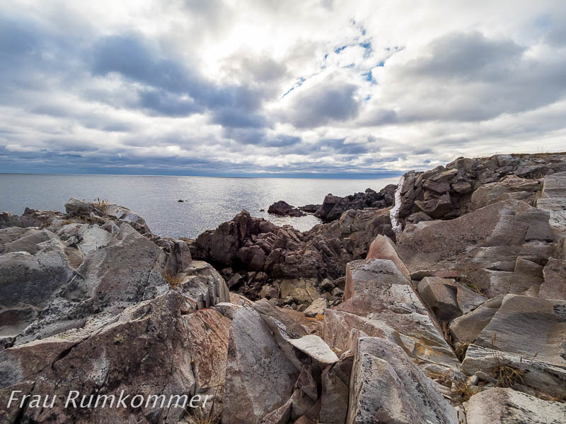
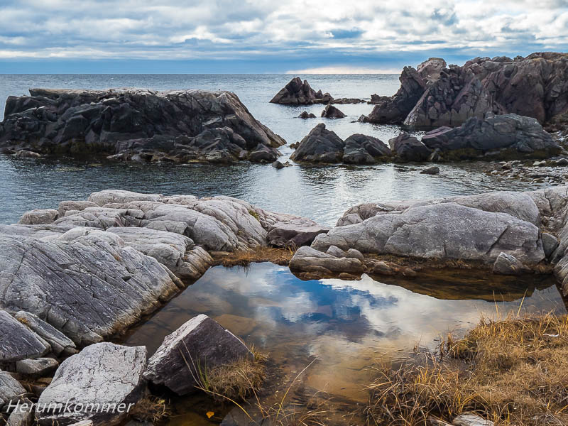
We are lucky, because the attraction, which in the summer leaves Percé overflowing with tourists, is also in the sun on this autumn day: the Rocher Percé, 5 million t of limestone, 88 m high, 438 m long. The erosion gnaws at it and has worked through a 20 m high archway. From an information board we learn that the rock will be completely crumbled in about 16,000 years. Well, we’ll see then! Mal wieder hat uns ein Straßenname von der Durchgangsstraße weggelockt: Die Leuchtturmstraße (Chemin du Phare) bei Gascons. Die Dirt Road durch den Wald ist abenteuerlich, ein wenig wie eine Achterbahn. Und dann, nach rund drei Kilometern, ist am Ende kein Leuchtturm aber der Traum jedes Landschaftsfotografen von einer zerklüfteten Felsküste. Der Leuchtturm ist schon vor Jahren abgebrannt, sein sechseckiges Fundament entdecken wir am nächsten Morgen.
No lighthouse anymore Once again, a road name lured us away from the thoroughfare: the lighthouse road (Chemin du Phare) near Gascons. The dirt road through the forest is adventurous, a bit like a roller coaster. And then, after about three kilometers, at the end, there is no lighthouse but the dream of every landscape photographer of a rugged cliff coast. The lighthouse burned down years ago and we discover its hexagonal foundation the next morning. Bei New Richmond machen wir einen Spaziergang zum Leuchtturm an Duthie’s Point. In der Nacht hat es gefroren aber der Herbstmorgen ist angenehm. Im Park stehen ein paar historische Gebäude, manche schlecht erhalten. Am Waldrand, höchstens 50 m von uns, stehen zwei Hirsche und beobachten uns neugierig. Sie ziehen sich erst in den Wald zurück, als sich ein Fahrzeug ihnen nähert.
Near New Richmond we take a walk to the lighthouse at Duthie’s Point. It has frozen at night but the autumn morning is pleasant. In the park are a few historic buildings, some poorly preserved. At the edge of the forest, no more than 50 meters from us, two deer stand and watch us curiously. They only retreat into the forest when a vehicle approaches. Die Gaspésie und Québec haben wir hinter uns gelassen und sind bei bestem Wetter nach New Brunswick weiter gefahren. Doch das gute Wetter hat sich schnell verabschiedet. Zwei Tage sind wir schon in heftigem Regen, Schneefall und zunehmendem Wind unterwegs. An Fotografieren ist kaum zu denken, lediglich ein paar Leuchtturmfotos gelingen: Einmal in strömendem Regen aus dem Fahrzeug, zweimal im Schneegestöber. Am Rand eines Fischereihafens haben wir einen Stellplatz für die Nacht gefunden. Hier zerrt der Sturm am Wohnmobil, aber es gibt nichts, mit dem er uns ein Fenster zerschmettern könnte. Doch gegen 20 Uhr klopft die Hafensicherheit an und bittet uns wegzufahren. Das Tor zum Hafen (das wir nicht wahrgenommen haben) wird geschlossen, wir dürfen nicht bleiben. Glücklicherweise beleuchtet ein fast voller Mond die Landschaft, sodass wir uns in der Dunkelheit einigermaßen orientieren können. Nachts ist es noch erheblich schwieriger, als bei Tageslicht, einen Stellplatz zu finden. Campingplätze sind alle seit Wochen geschlossen. Im Kochibouguac National Park werden wir fündig. Auch hier ist der Campingplatz geschlossen, aber an einem großen Bootsanleger ist viel Platz. Zu unserer Überraschung ist es windstill geworden. Die Nacht ist klirrend kalt und am Morgen strahlt auch wieder die Sonne.
From the storm into the frost We left the Gaspésie and Québec behind and drove on to New Brunswick in the best of weather. But the good weather has passed quickly. Two days we are already on the way in heavy rain, snowfall and increasing wind. It is almost unthinkable to photograph, only a few lighthouse photos succeed: Once in the pouring rain from the vehicle, twice in the snowstorm. At the edge of a fishing port, we have found a parking space for the night. Here the storm tugs at the camper, but there is nothing it could smash us a window. But around 8 p.m. the port security knocks and asks us to drive away. The gate to the port (which we did not notice) will be closed, we can not stay. Fortunately, an almost full moon illuminates the landscape so we can orient ourselves in the dark. At night it is even more difficult to find a pitch than in daylight. Campsites are all closed for weeks. In Kochibouguac National Park we find it. Here too, the campsite is closed, but there is plenty of room at a large jetty. To our surprise, it has become calm. The night is freezing cold and in the morning the sun is shining again. Nein, es geht nicht um Streufahrzeuge. Die Konstruktion der in Kanada verbreiteten einfachen Leuchttürme aus Holz wird offiziell als Salzstreuer-Design (saltshaker design) bezeichnet. Der Leuchtturm Richiboucto Head am Cap Lumière steht im Schnee. Es ist kalt aber die Sonne taucht die Küste der Northumberland Strait in gleißendes Licht.
Saltshaker in the snow No, it’s not about salt spreading trucks. The construction of the simple lighthouses made of wood in Canada is officially called saltshaker design. The lighthouse Richiboucto Head at Cap Lumière is in the snow. It’s cold but the sun is shining on the shore of the Northumberland Strait. Weiter südlich, bei Shediac, steht der hintere der beiden Leuchttürme am Pointe du Chène auf „hohen Absätzen“. Der würde vermutlich als Pfeffermühle durchgehen. Hier liegt zwar kein Schnee, aber der Indian Summer hat Pause.
Further south, near Shediac, the rear lighthouse at the Pointe du Chène is on „high heels“. That would probably be a pepper mill. There is no snow here, but the Indian Summer has a break. An der Südküste von New Brunswick, an der Bay of Fundy, ist die Strömung der Fließgewässer, die in die Bucht münden, meistens sehr hoch. Oder diese Bäche und Flüsse sehen aus, wie ausgepumpt. Der Grund dafür, dass sie sich schnell und fast vollständig entleeren, ist der extreme Gezeitenhub in der Bucht. Bis zu 16 m beträgt hier der Unterschied zwischen Ebbe und Flut. Entsprechend laufen die Gewässer auch schnell wieder vollständig voll.
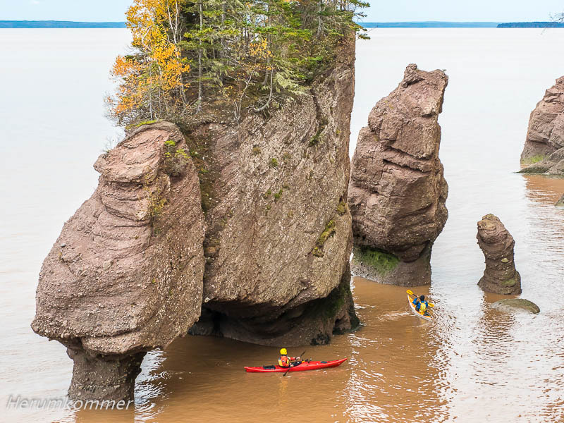
At the south coast of New Brunswick, at the Bay of Fundy, the flow of streams that flow into the bay is usually very high. Or these streams and rivers look like being pumped out. The reason they empty quickly and almost completely is the extreme tidal range in the bay. Up to 16 m is here the difference between low and high tides. Accordingly, the waters run full again quickly. Zweimal täglich stehen die Hopewell Rocks tief im Wasser, wie auf den folgenden Fotos. Und zweimal kann man zwischen den Felsen, die wegen ihres Bewuchses auch Flowerpot Rocks (Blumentopf-Felsen) genannt werden, spazieren gehen. Im Herbst ist der Zugang zum Meeresboden allerdings gesperrt.
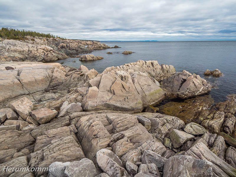
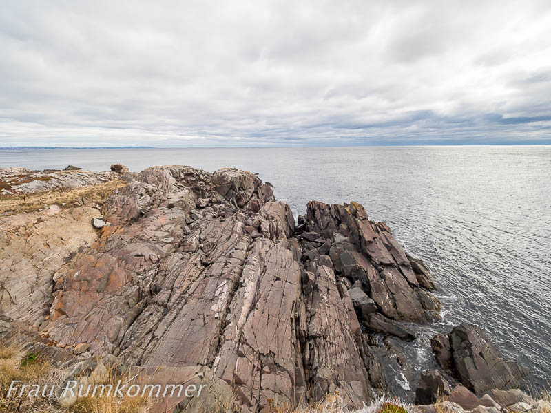
Twice a day, the Hopewell Rocks are deep in the water, as in the following images. And twice you can walk between the rocks, which are also called Flowerpot Rocks because of their plant cover. In autumn, however, the entrance to the seabed is closed. Der extreme Gezeitenhub in der Bay of Fundy ist auch an der Steilküste am Quako Head gut zu sehen. Die zerklüftete Küste ragt hier in die Bucht hinein. Direkt gegenüber ist eine Felseninsel der Brandung ausgesetzt. Bei Flut ist von ihr vermutlich nicht viel zu sehen. Bei relativ niedrigem Wasserstand können wir beobachten, wie die Wellen zwischen Festland und Insel gegeneinander laufen. Dies ist ein besonders spektakulärer Ort für einen Leuchtturm. Seine herunter gekommene Fassade passt zum unwirtlichen Wetter.
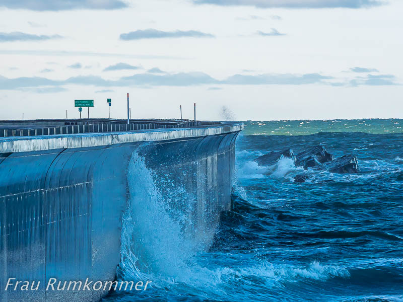
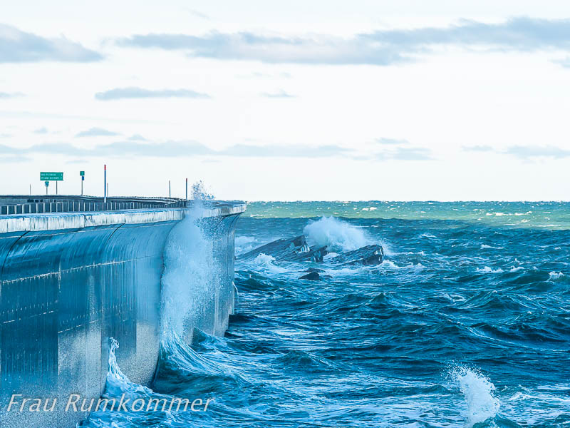
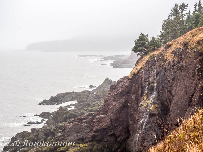
The extreme tidal range in the Bay of Fundy can also be seen on the cliffs at Quako Head. The rugged coast protrudes here into the bay. Directly opposite a rocky island is exposed to the surf. At high tide there is probably not much to be seen of it. At relatively low water levels, we can watch the waves between the mainland and the island run against each other. This is a particularly spectacular spot for a lighthouse. Its run down facade fits the barren weather. Die größte Stadt in New Brunswick ist Saint John. Dort fließt der Saint John River durch eine Schlucht und über Stromschnellen in die Hafenbucht an der Bay of Fundy. Der große Tidenhub in der Bucht führt hier zu dem ungewöhnlichen Phänomen der sich umkehrenden Wasserfälle (Reversing Falls / Reversing Rapids). Die Stromschnellen liegen unter zwei großen Brücken über den Fluss. Trotz miserablem Wetter ist auf den folgenden Bildern zu erkennen, dass das Wasser nach rechts in die Hafenbucht abfließt.
The largest city in New Brunswick is Saint John. There, the Saint John River flows through a gorge and over rapids in the habour bay at the Bay of Fundy. The large tidal range in the bay leads to the unusual phenomenon of reversing falls / reversing rapids. The rapids lie under two large bridges across the river. Despite miserable weather, the following pictures show that the water drains off to the right into the harbour bay. Etwas mehr als eine Stunde später hat sich die Fließrichtung umgekehrt, das Wasser strömt in die Schlucht. Vom anderen Flussufer aus ist das besonders deutlich zu sehen.
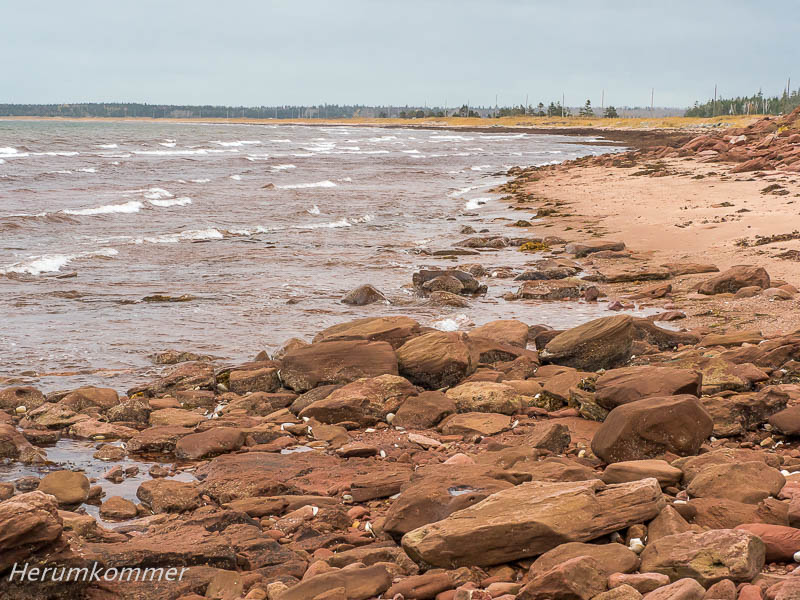
Just over an hour later, the flow direction has reversed, the water rushes into the gorge. From the other river bank this can be seen particularly clearly. In der Hoffnung auf weniger grauen Himmel sind wir nach Prince Edward Island weiter gereist. Der Erfolg lässt noch auf sich warten. Die Insel ist von roter Erde geprägt. Am spektakulären Cap Egmont an der Northumberland Strait ist zu sehen, dass auch die Steilküste rot ist und das Meerwasser färbt.
Hoping for less gray skies, we continued to Prince Edward Island. The success is not yet here. The island is characterized by red soil. At the spectacular Cap Egmont at Northumberland Strait one can see that the cliffs are also red and colour the sea water. Beim Leuchtturm West Point haben wir endlich mal wieder zeitweise blauen Himmel. Der schöne Strand hier ist, wie fast ganz Prince Edward Island rotbraun. Die ersten Herbststürme haben hier schon die Dünen angegriffen.
At the West Point lighthouse we finally have blue sky again temporarily. The nice beach here, like almost all of Prince Edward Island, is reddish brown. The first autumn storms have already attacked the dunes here. Die Saison zum Fang von Hummern ist offensichtlich beendet. Viele der speziellen Fischerboote sind an Land geholt und zur Überwinterung aufgeständert. Beim Hafen von Howards Cove sind die Hummerfallen schon auf Anhängern gestapelt und Taue ordentlich zusammen gelegt.
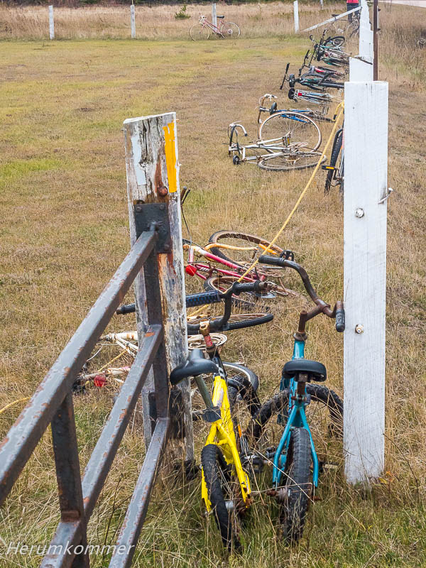
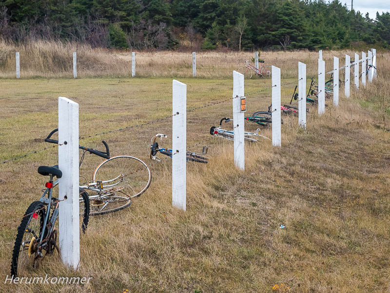
End of the fishing season The season for catching lobsters is obviously over. Many of the special fishing boats have been taken ashore and raised for winter storage. At the port of Howards Cove, the lobster traps are already stacked on trailers and ropes neatly put together. Am North Cape von Prince Edward Island wollen wir den Leuchtturm sehen. Doch kurz bevor wir ihn erreichen, entdecken wir eine besonders skurrile Zaun-Dekoration. In der Prärie Saskatchewans fanden wir Stiefel schon bemerkenswert, und in Alberta Mützen als Zaun-Deko. Aber Fahrräder sind noch eine andere Dimension von Schmuck.
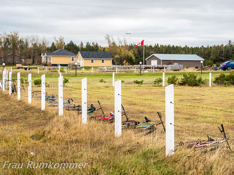
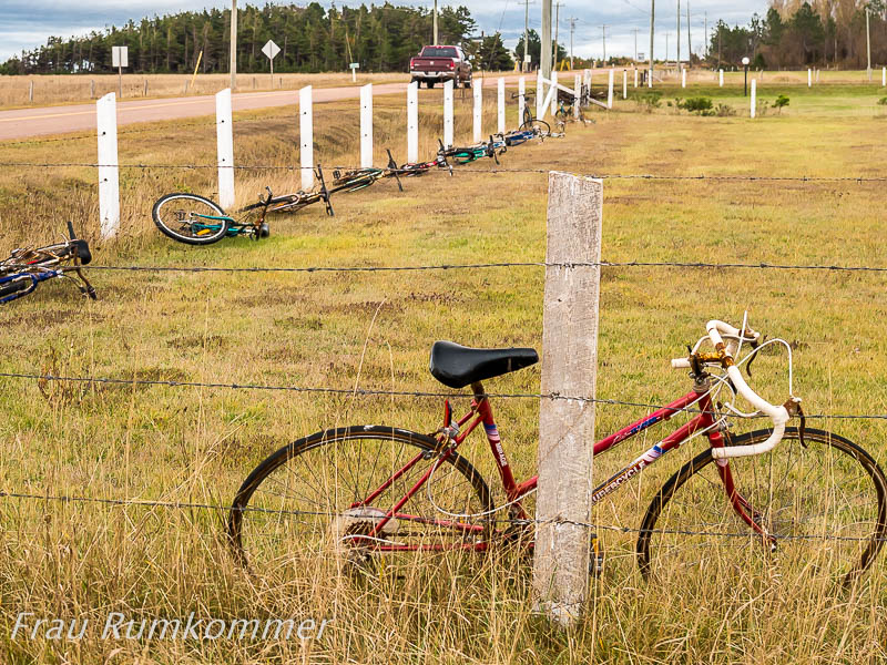
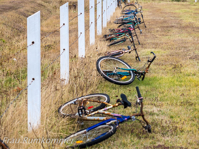
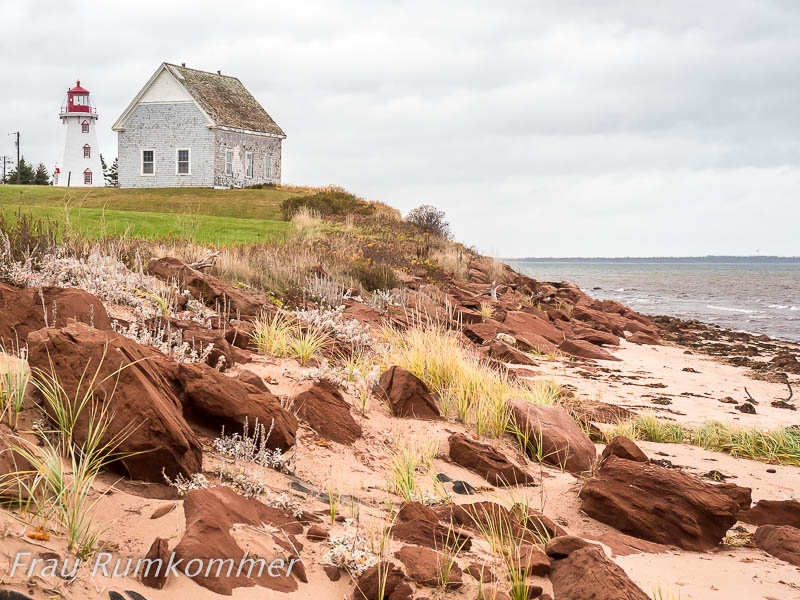
At the North Cape of Prince Edward Island we want to see the lighthouse. But just before we reach it, we discover a particularly bizarre fence decoration. In the prairie of Saskatchewan we found boots remarkably, and in Alberta caps as a fence decoration. But bikes are still another dimension of ornament. In ganz Nordamerika gibt es keine Provinz und keinen Bundesstaat (in den USA), wo so viele Leuchttürme auf so kleiner Fläche stehen, wie auf Prince Edward Island. Besonders schön ist die „Leuchtturm-Familie“ von Wood Islands. Ein weiterer schöner mit attraktiver Landschaft ist der Leuchtturm Panmure Head auf Panmure Island. Die kleine Insel ist auf der Straße über eine Nehrung erreichbar. Unmittelbar am Turm gibt es keinen Zugang zum Strand, vermutlich weil die Steilküste unwegsam ist. Also fahren wir zurück zur Nehrung, wandern am Wasser entlang und klettern durch das Geröll, das das Meer aus der Küste gewaschen hat.
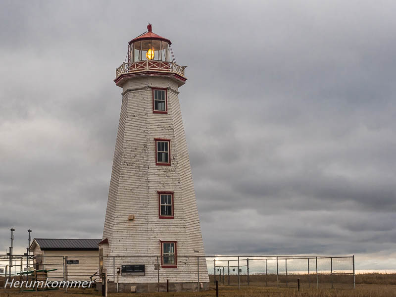
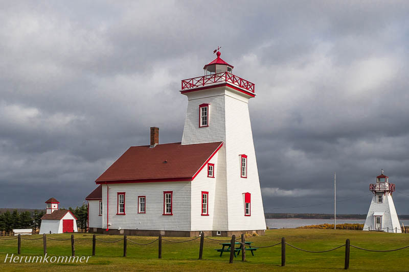
Throughout North America, there is no province or state (in the US) where so many lighthouses stand on such a small area as on Prince Edward Island. Particularly beautiful is the „lighthouse family“ of Wood Islands. Another beautiful one with an attractive landscape is the Panmure Head lighthouse on Panmure Island. The small island can be reached on the road via a spit. Immediately at the tower there is no access to the beach, presumably because the cliff is impassable. So we drive back to the spit, walk along the water and climb through the scree, which the sea washed off the coast. Bei Cable Head East an der Nordküste von Prince Edward Island führt ein Weg zum Badeplatz Beaver Point. Eine Fahrspur oberhalb der Steilküste reicht noch ein paar hundert Meter weiter. Hier haben wir einen fantastischen Stellplatz mit Blick über den Gulf of St. Lawrence. Im Laufe des Abends geht der Regen in einen Sturm über. Unser Womo steht (zufällig) parallel zur Windrichtung. Dennoch reißt und rüttelt daran der heftigste Sturm, den wir darin je erlebt haben. Das ist sehr beunruhigend und wir finden kaum Schlaf. Aber wir sehen auch keine Alternative zu diesem Stellplatz. Nach jedem Sturm haben wir entwurzelte, umgestürzte Bäume und morsche Äste auf den Straßen gesehen. Vor solchen und weiteren „Flugkörpern“ sind wir hier auf der weiten, kahlen Fläche sicher. Die 3,5 Tonnen unseres Womo haben sich trotz seiner Höhe von 3,25 m nicht vom Sturm umwerfen lassen. Der lässt am Morgen etwas nach, sodass wir uns nach dem Frühstück nach draußen wagen. Mehr als ein kurzer Strandspaziergang wird es aber nicht. War am Vorabend alles triefend nass, hat der Sturm es wie ein Fön trocken geblasen. Am Strand sind wir Sandstürmen ausgesetzt. Höchste Zeit, wegzufahren, bevor das Wohnmobil gesandstrahlt wird.
Near Cable Head East at the north shore of Prince Edward Island, a path leads to the Beaver Point bathing spot. A track above the cliff still continues for a few hundred meters. Here we have a fantastic pitch with views over the Gulf of St. Lawrence. During the evening, the rain turns into a storm. Our camper stands (coincidentally) parallel to the wind direction. Nevertheless, the most violent storm we have ever experienced in it, ruptures and shakes it. This is very worrying and we hardly find sleep. But we also see no alternative to this pitch. After each storm we saw uprooted, fallen trees and rotten branches on the streets. Of such and other „missiles“ we are safe here on the wide, bare surface. The 3.5 tons of our camper, despite its height of 3.25 m, could not be knocked over by the storm. That fades a bit in the morning, so we venture out after breakfast. It is not more than a short beach walk. Everything was dripping wet in the eve, the storm blew it dry like a hair dryer. On the beach we are exposed to sandstorms. High time to drive away before the motorhome gets sandblasted. Canada’s east in autumn
Gaspési-Nordküste


Penouille


Last Minute Glück

Rocher Percé


Kein Leuchtturm mehr
Duthie’s Point


Vom Sturm in den Frost


Salzstreuer im Schnee


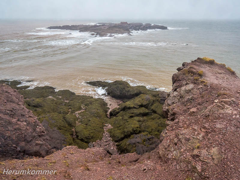
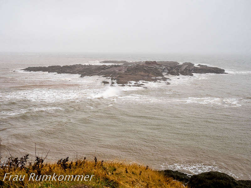
Bay of Fundy


Quako Head


Reversing Falls


Cap Egmont


West Point


Ende der Fangsaison


North Cape
Panmure Head


Beaver Point